Locating and Understanding Public Land Survey System (PLSS) Plats
What are PLSS Plats?
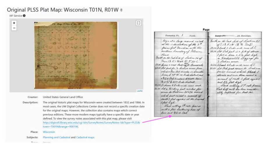
Section titled “What are PLSS Plats?”Plats (maps) of the public land survey of the United States are a valuable resource for original land survey information, as well as for understanding landscape history. The work was done using the Public Land Survey System (PLSS), which divides land into six-mile square townships and one-mile square sections. It established the township, range and section grid; the pattern upon which land ownership and land use is based. The aim of the survey was to divide the land into lots that could be sold, or otherwise divested, to raise funds for the federal government and to encourage settlement. In general, this work took place near the end of the 18th century and throughout the 19th century. Survey dates for specific plats vary depending on the state/region.
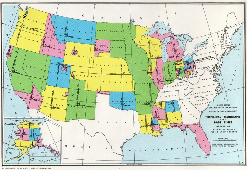
The survey work was done by the General Land Office (GLO), an agency of the Treasury Department until 1849 and thereafter a part of the Interior Department. In 1946, the GLO was merged with the Grazing Service to create the modern Bureau of Land Management (BLM), which continues to have responsibility for the Public Land Survey on public domain lands. The original surveys are often referred to as the Public Land Survey or the General Land Office Survey.

Field Survey Notes
Section titled “Field Survey Notes”The work of the public land surveys was recorded in small notebooks that became the official record. Collectively these are known as the field notes. Within an individual township notebook, there is a predictable progression of entries. Most field notebooks include basic entries such as a Title Page, Sketch Map, Section Line Notes, Meander Notes, General Description, and an Affidavit. The field notes may or may not be directly connected to the plat itself in the geoportal, but links to where they can be accessed may be found in the metadata.
Locating PLSS Plats in the BTAA Geoportal
Section titled “Locating PLSS Plats in the BTAA Geoportal”Original PLSS plats are not available in the geoportal for all areas of the United States. However, there are a few recommended ways to quickly see what plats do exist - by using different facets combined with the map search option.
1. Find the PLSS collection
Section titled “1. Find the PLSS collection”One of the collections in the BTAA Geoportal is titled “General Land Office Township Plats.”
- You can use this direct link to browse items in the collection
- To find this link again, use the Resource Class facet and select “Collections.” Then, choose “General Land Office Township Plats.” A widget at the bottom is labeled “Collection records”, which will ink to the list of General Land Office Township Plats.
2. Narrow down by place
Section titled “2. Narrow down by place”There are several options for finding a plat by place name:
-
Option 1: Focus the map on the search results page to your area of interest. Use the map tools (+ -) to zoom to your desired area.
-
Option 2: Click on a term in the Place facet. Most PLSS maps have state and county names attached.
-
Option 3: Use the text box to search by Township Ranges. For example, use the format “T063N-R18W” for Township 64 North Range 18 West.
Other Sources of Information and Access for PLSS Plats
Section titled “Other Sources of Information and Access for PLSS Plats”The GLO surveyed and mapped much of the midwest and western United States. If plats for your area of interest are not available through the B1G Geoportal, you can search for them in the BLM’s digital General Land Office Records. This website also provides access to surveyor field notes and guides to interpreting the PLSS. State governments also received a copy of the plat maps when they were certified. Access to these copies is sometimes available through state historical societies, land offices, or map libraries.
More Resources
Section titled “More Resources”- Interpreting plats: physical features, boundary lines and measurements, other text and tables
- A detailed history of the PLSS: A History of the Rectangular Survey System
- Wisconsin Public Land Survey Plats and Notes Information
- Minnesota Public Land Survey Retrieval System