Big Ten GIS Conference
Map Gallery
Browse the Map Gallery to see how contributors are using GIS to tell stories, solve problems, and visualize data. Submissions include both static and interactive projects created with a variety of tools and approaches.
26 maps in 2026
Interactive Maps
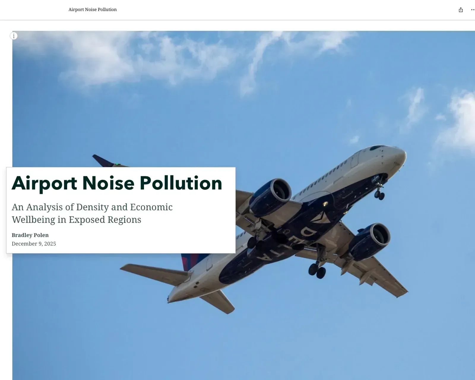
Airport Noise Pollution: An Analysis of Density and Economic Wellbeing in Exposed Regions
Bradley S Polen (The Ohio State University)
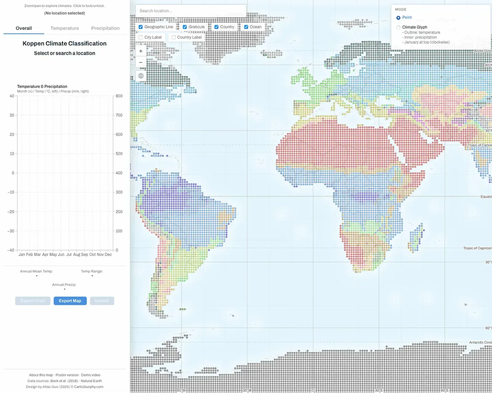
Climate Visualized
Atlas Guo (University of Wisconsin-Madison)
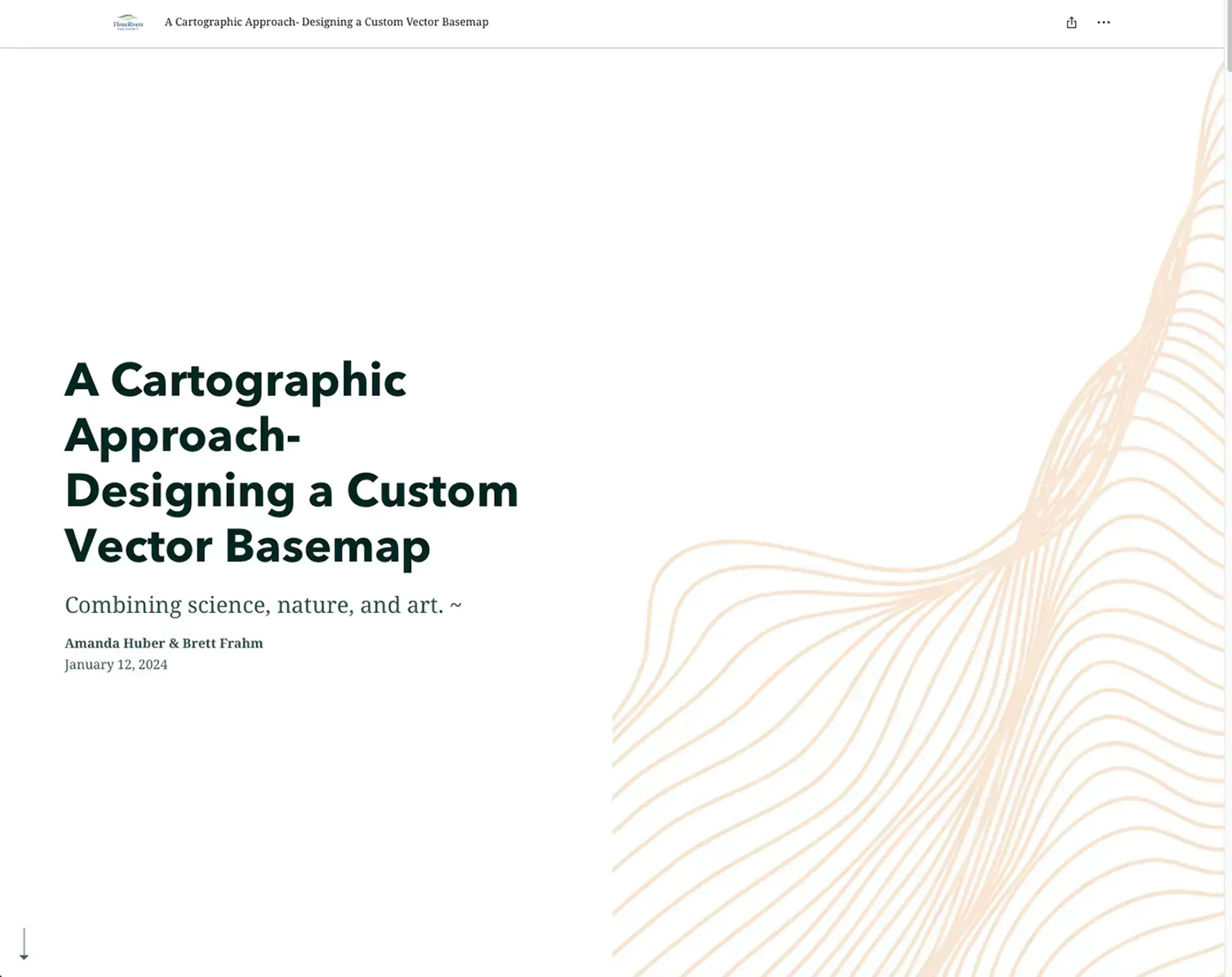
Dynamic Cartography- A Custom Online Vector Basemap, Three Rivers Park District
Amanda Huber (Three Rivers Park District); Brett Frahm
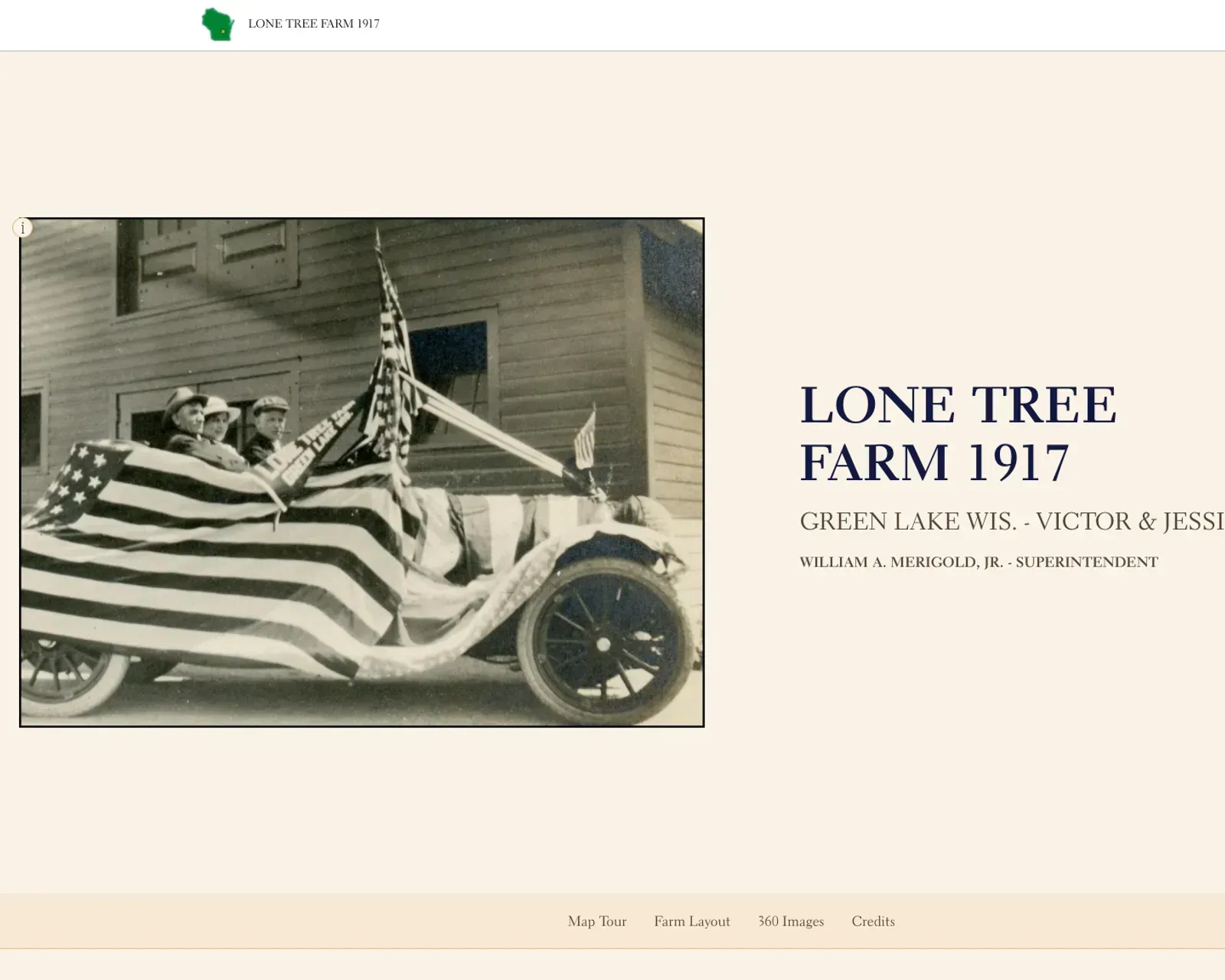
Lone Tree Farm 1917
Gerald Stanuch (Green Lake County, Wisconsin)

MD Transportation Trails Strategic Plan: An Integrated ArcGIS Web Application for Professional Practice and GIS Education
Andrew Bernish (University of Maryland, College Park); Aviva Klugh (University of Maryland and Maryland Department of Transportation); Meg Young (Maryland Department of Transportation)
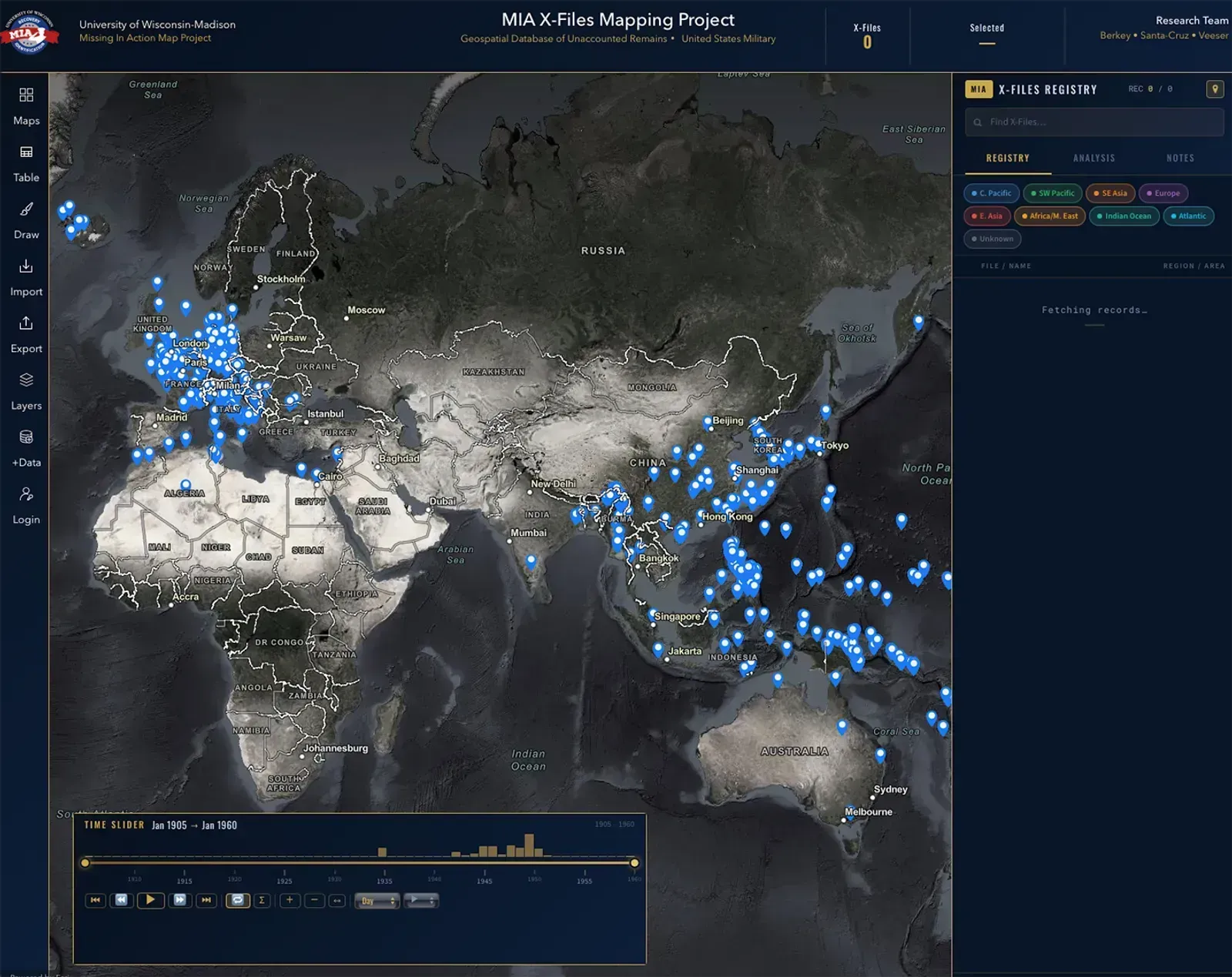
MIA X-Files Mapping Project
Jack Cornell Berkey (University of Wisconsin-Madison); Haley Veeser, Andrew Santa-Cruz, University of Wisconsin-Madison
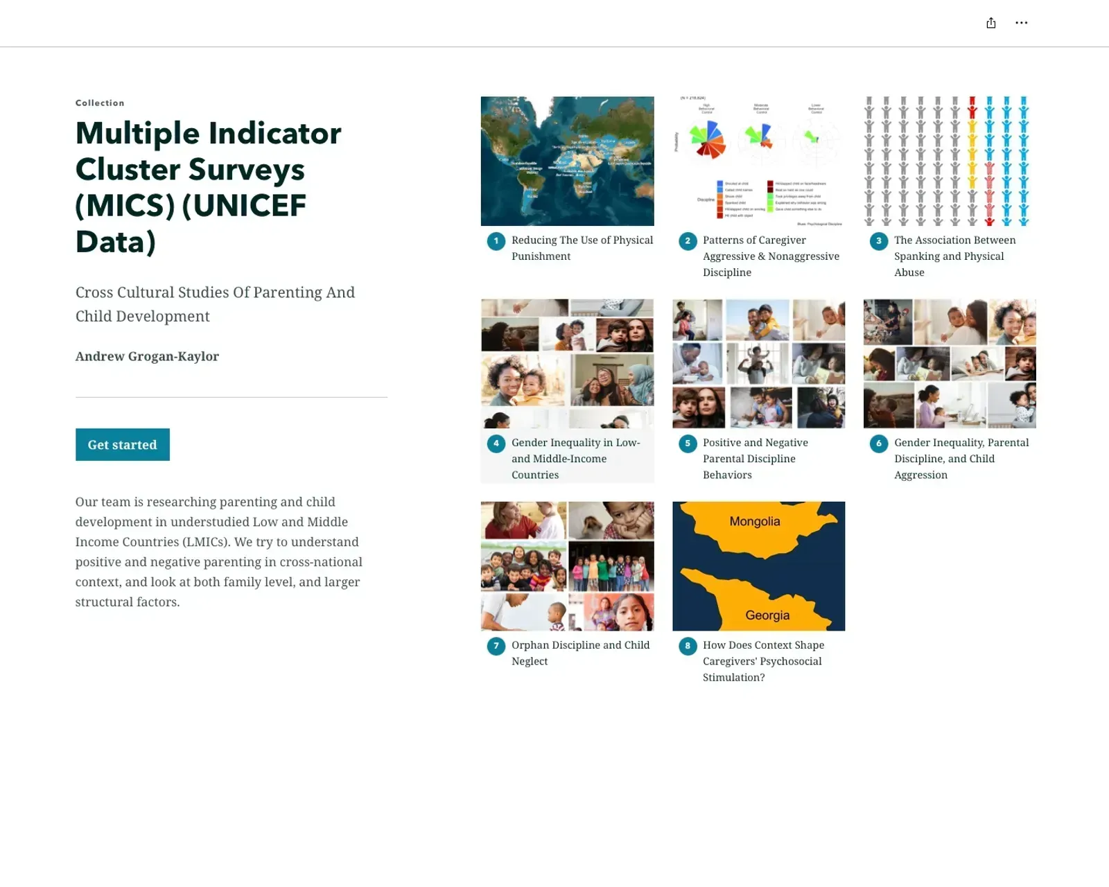
Multiple Indicator Cluster Surveys (MICS) (UNICEF Data): Cross Cultural Studies Of Parenting And Child Development
Andy Grogan-Kaylor (University of Michigan)
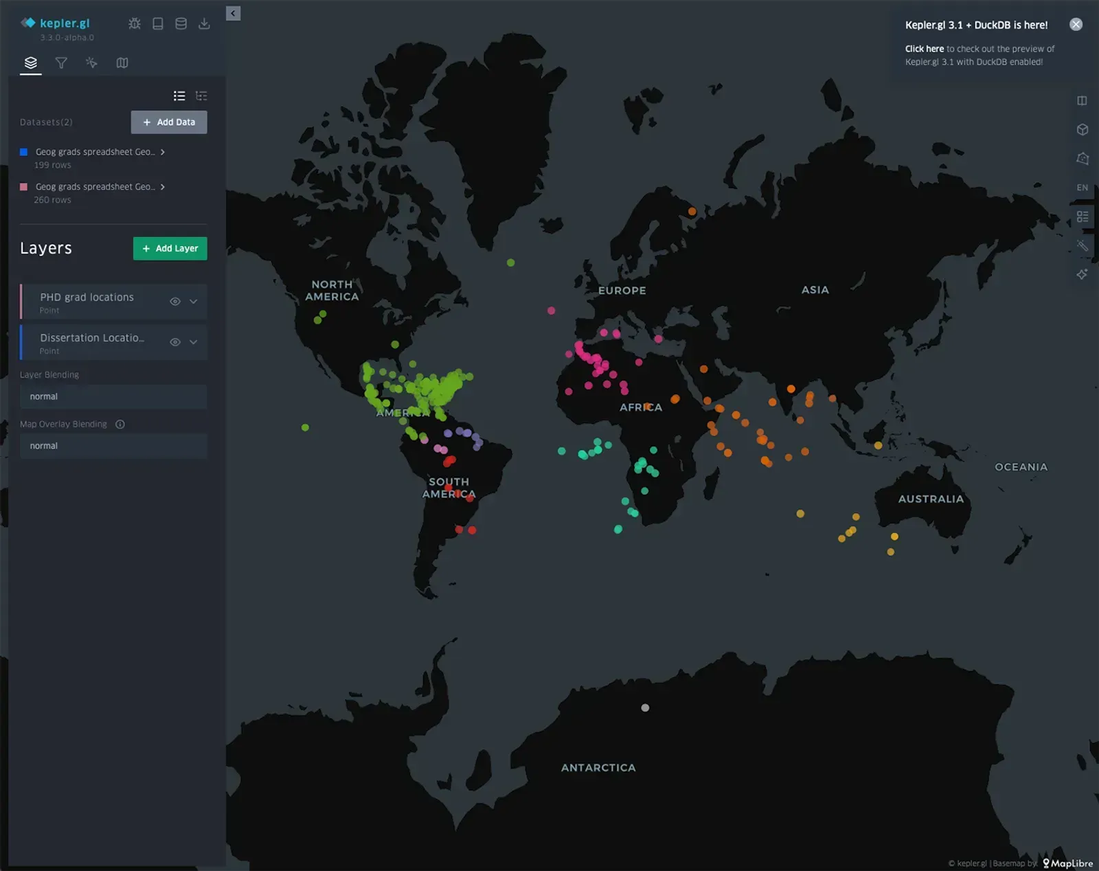
The Global Influence of Historic Penn State Geography PHD's
Zachary D Probolus (Penn State); Penn State Geography Department
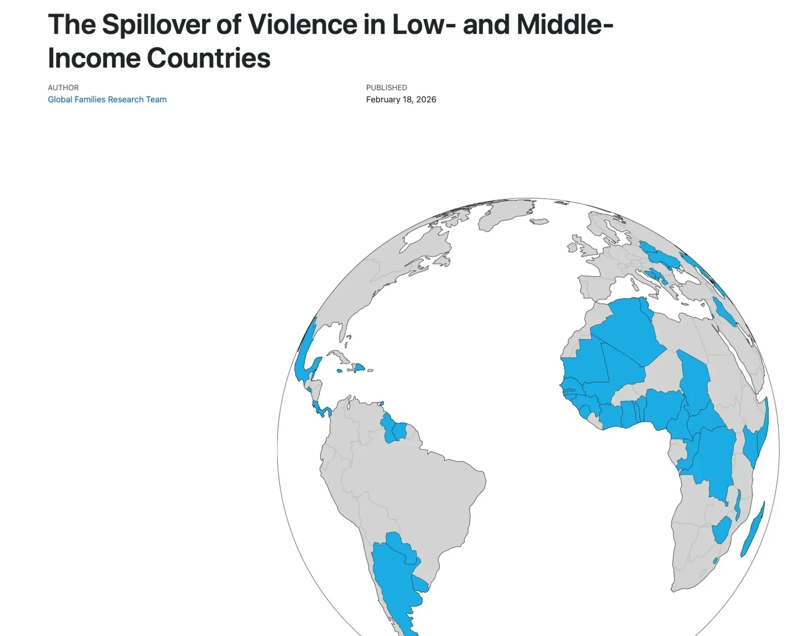
The Spillover of Violence in Low- and Middle-Income Countries
Andy Grogan-Kaylor (University of Michigan); Julie Ma (UM-Flint)
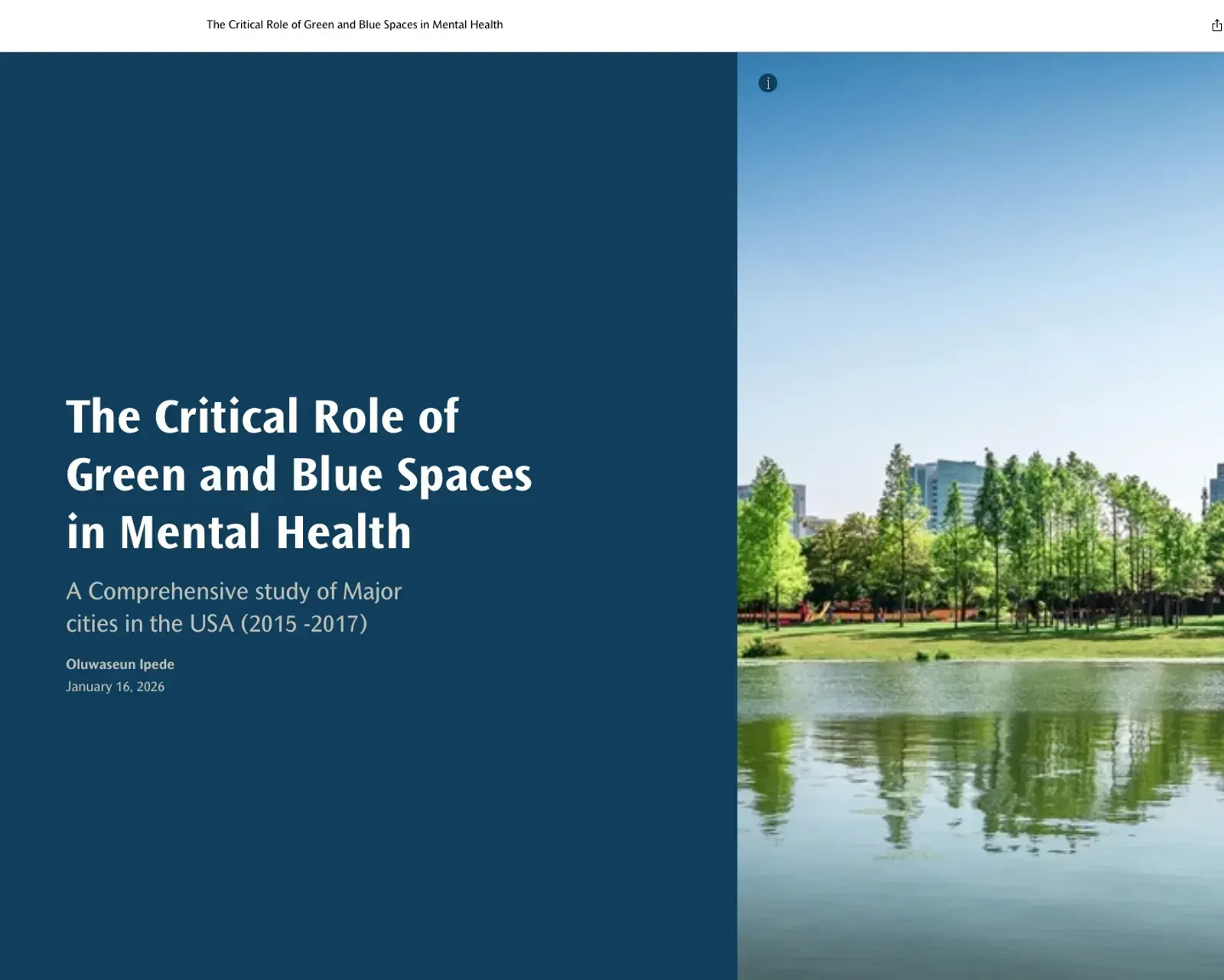
Urban Oases: The Critical Role of Green and Blue Spaces in Mental Well-Being
Oluwaseun Johnson Ipede (Jacobs Engineering)
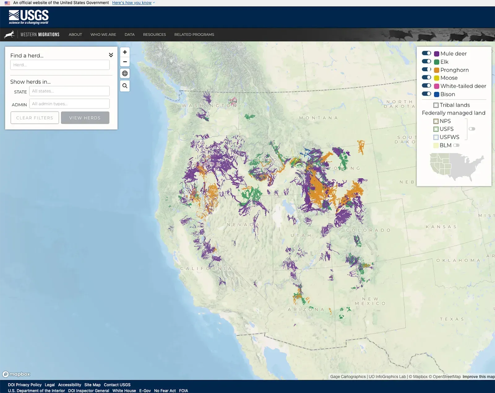
Western Migrations Atlas
Joanna Merson (University of Oregon InfoGraphics Lab); Matt Kauffman; Blake Lowrey (UGSG) Josh Gage (Gage Cartographics); Erik Steiner (University of Oregon)
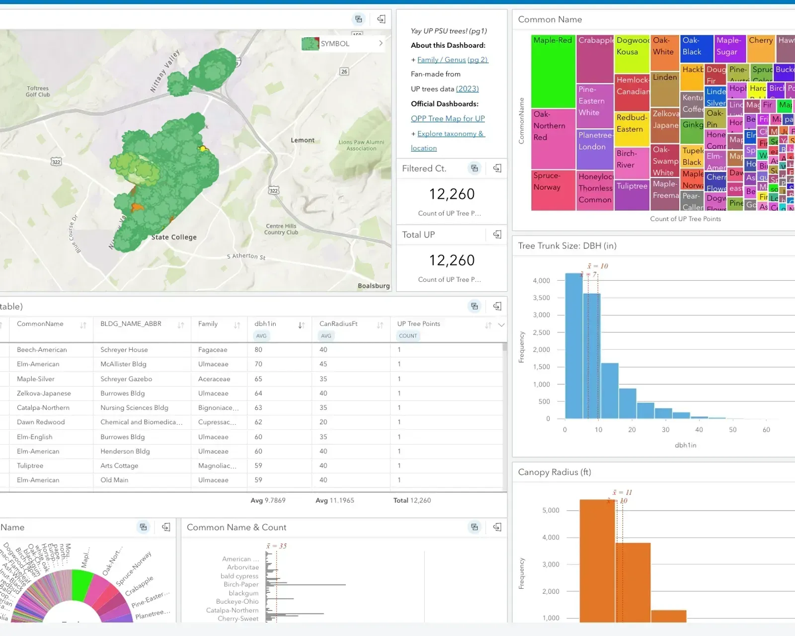
Yay Trees! – Exploring the Trees of Penn State - University Park
Eliza S. Bradley (Penn State University)
Static Maps
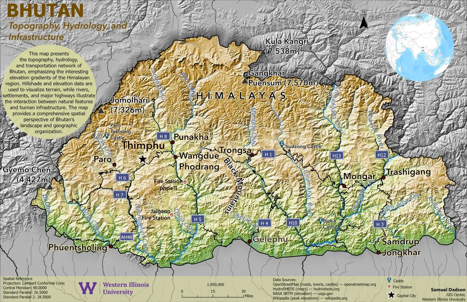
Bhutan: Topography, Hydrology, and Infrastructure
Samuel Dadson (Western Illinois University)
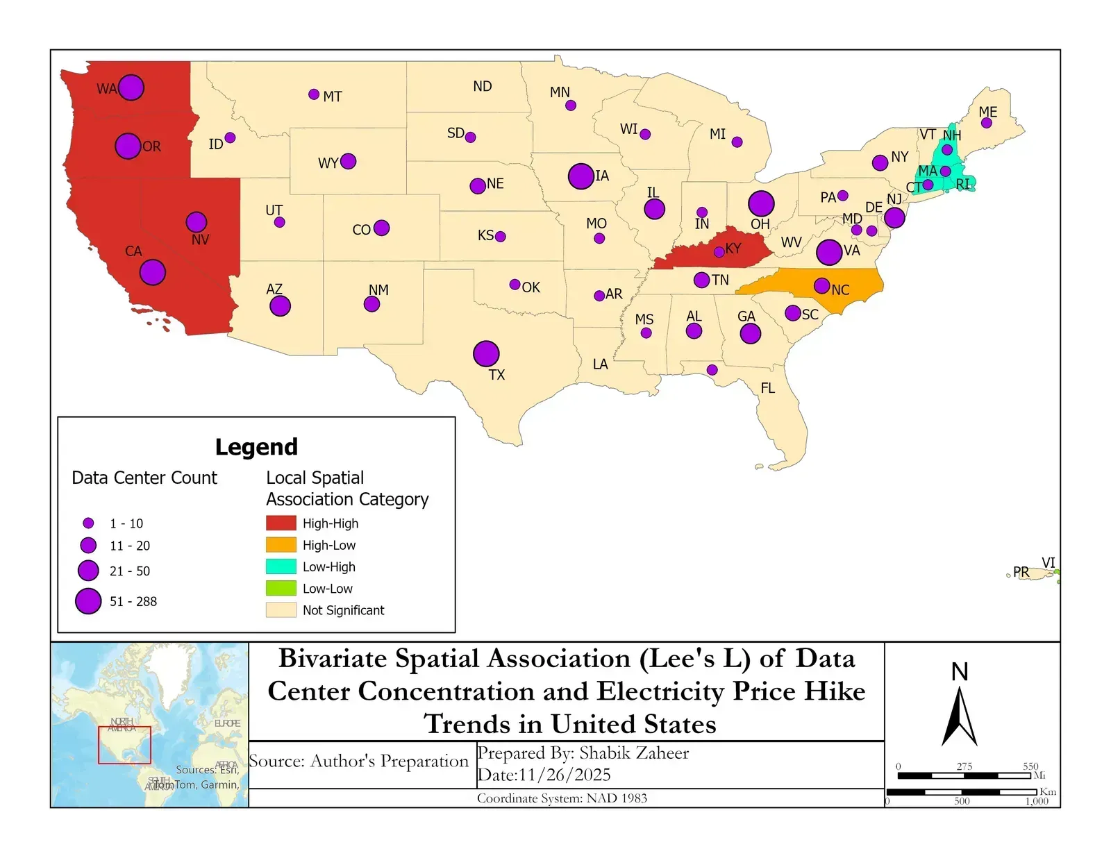
Bivariate Spatial Association (Lee's L) of Data Center Concentration and Electricity Price Hike Trends in United States
Shabik Zaheer (Southern Illinois University Carbondale)
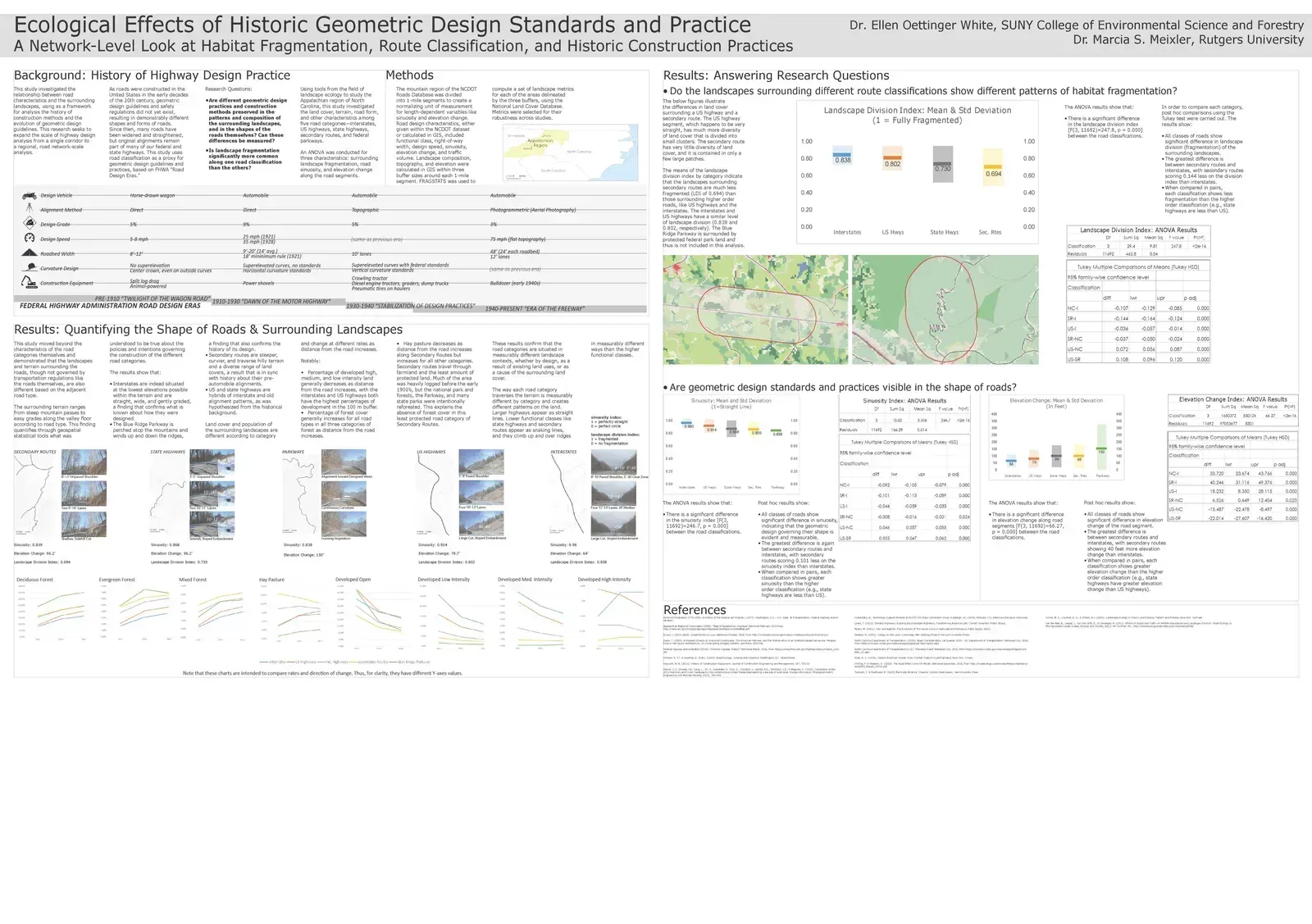
Ecological effects of historic geometric design standards and practice
Marcia S. Meixler (Rutgers University); Ellen Oettinger White (SUNY ESF)
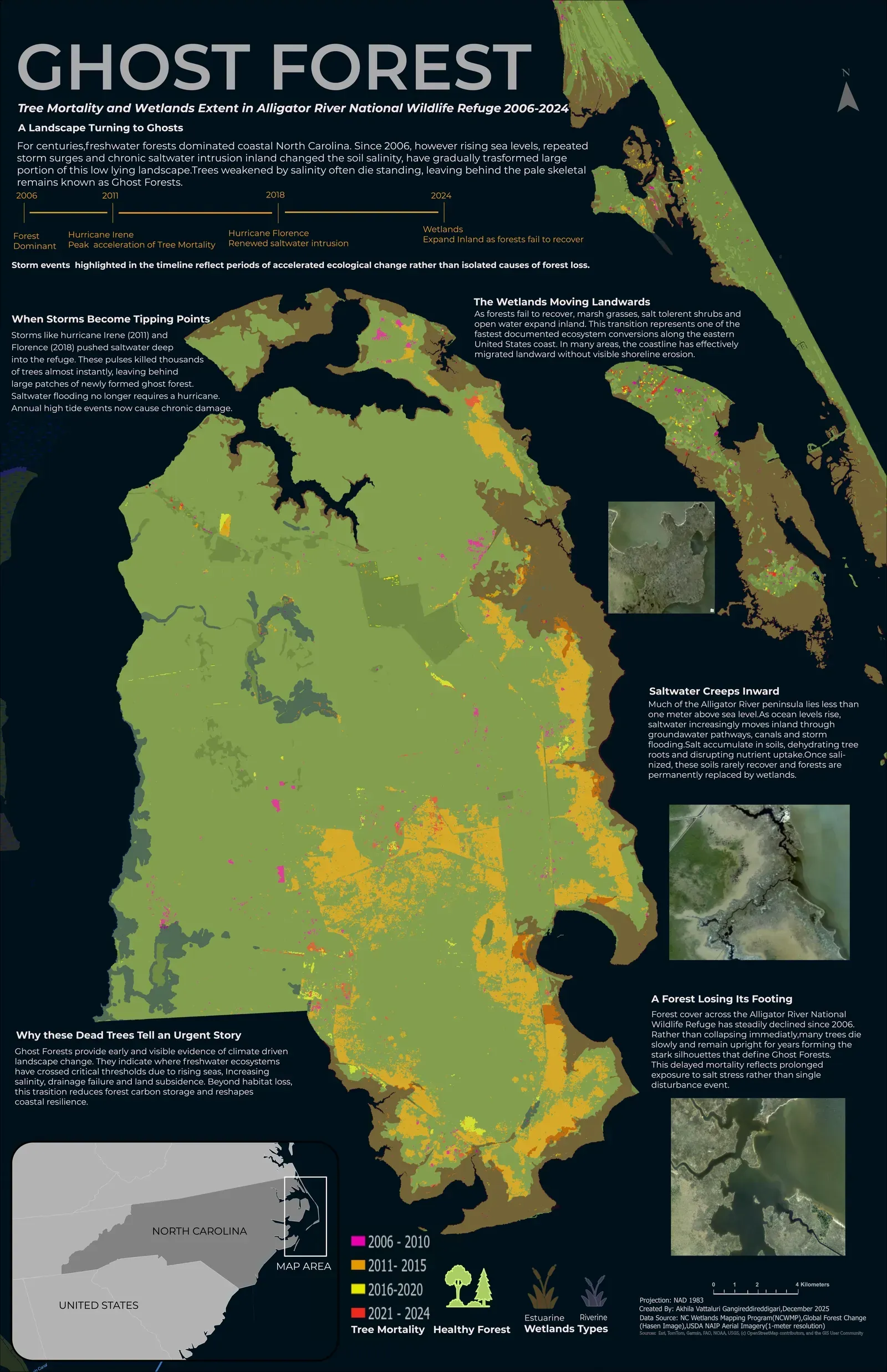
Ghost Forest
Akhila Vattaluri Gangireddigari (University of Wisconsin-Madison); Akhila Vattaluri Gangireddigari (University of Wisconsin-Madison)
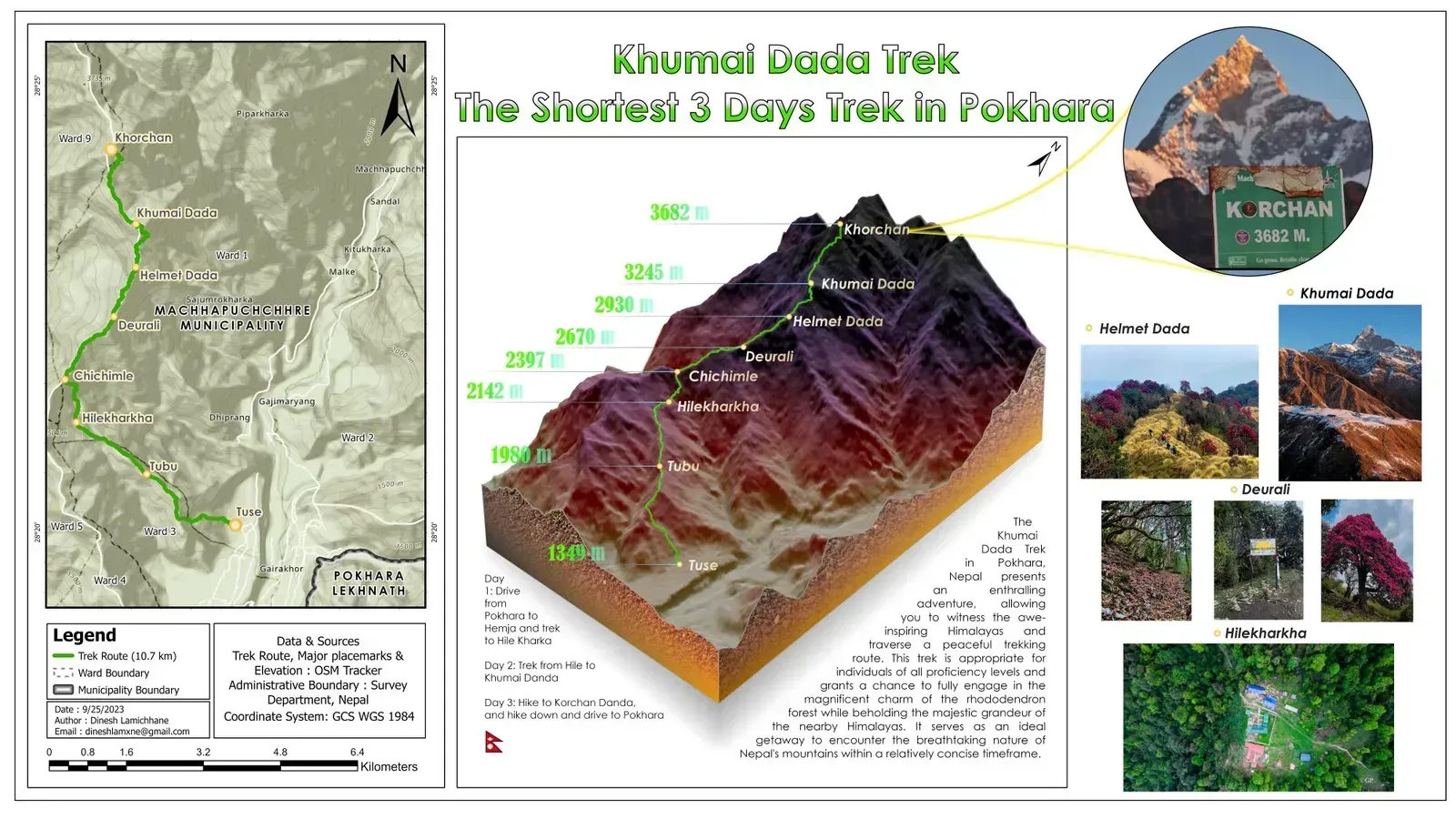
Khumai Dada Trek: The Shortest 3 Days Trek in Pokhara
Dinesh Lamichhane (Jacksonville State University)
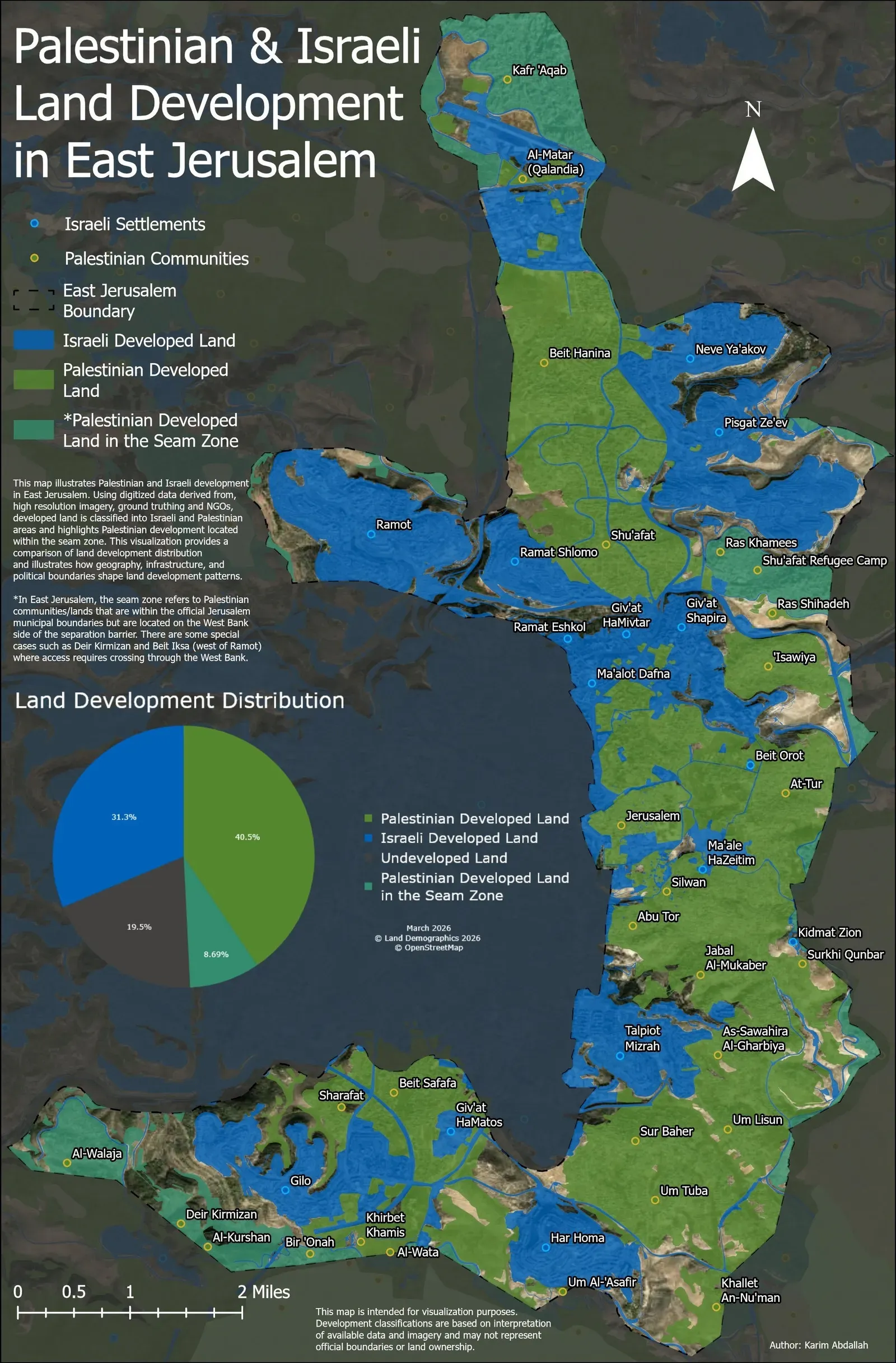
Palestinian & Israeli Land Development in East Jerusalem
Karim K Abdallah (University of Maryland)
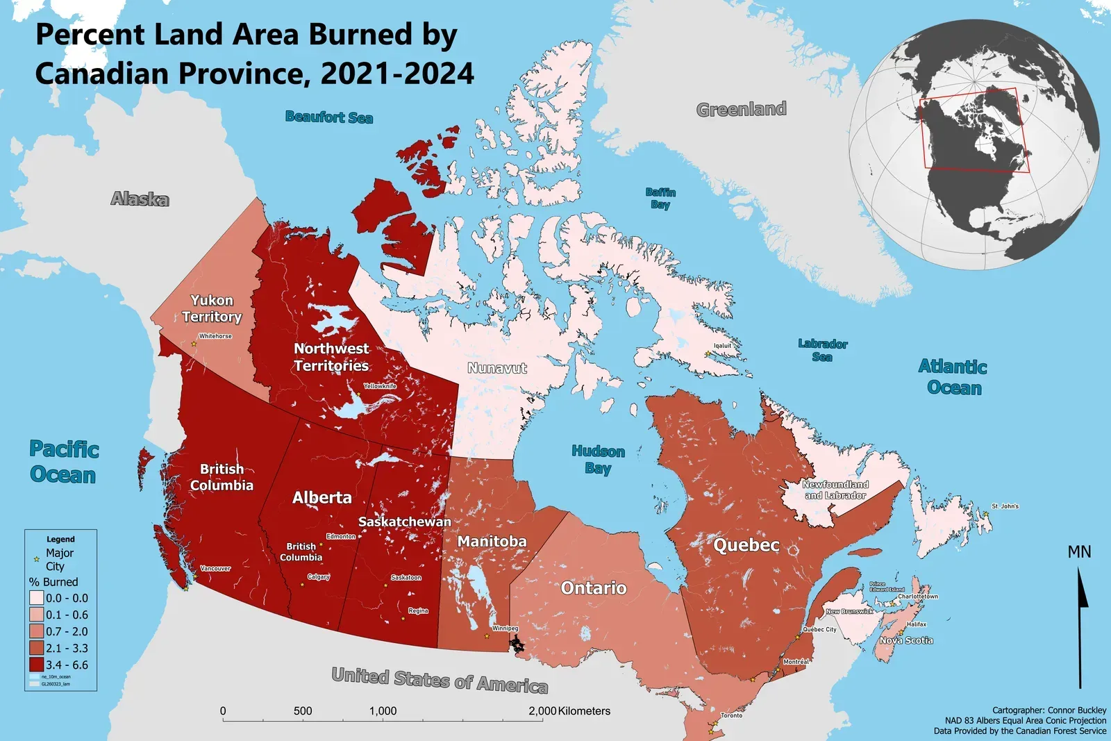
Percent Land Area Burned by Canadian Province. 2021-2024
Connor M Buckley (University of Minnesota, Twin Cities)
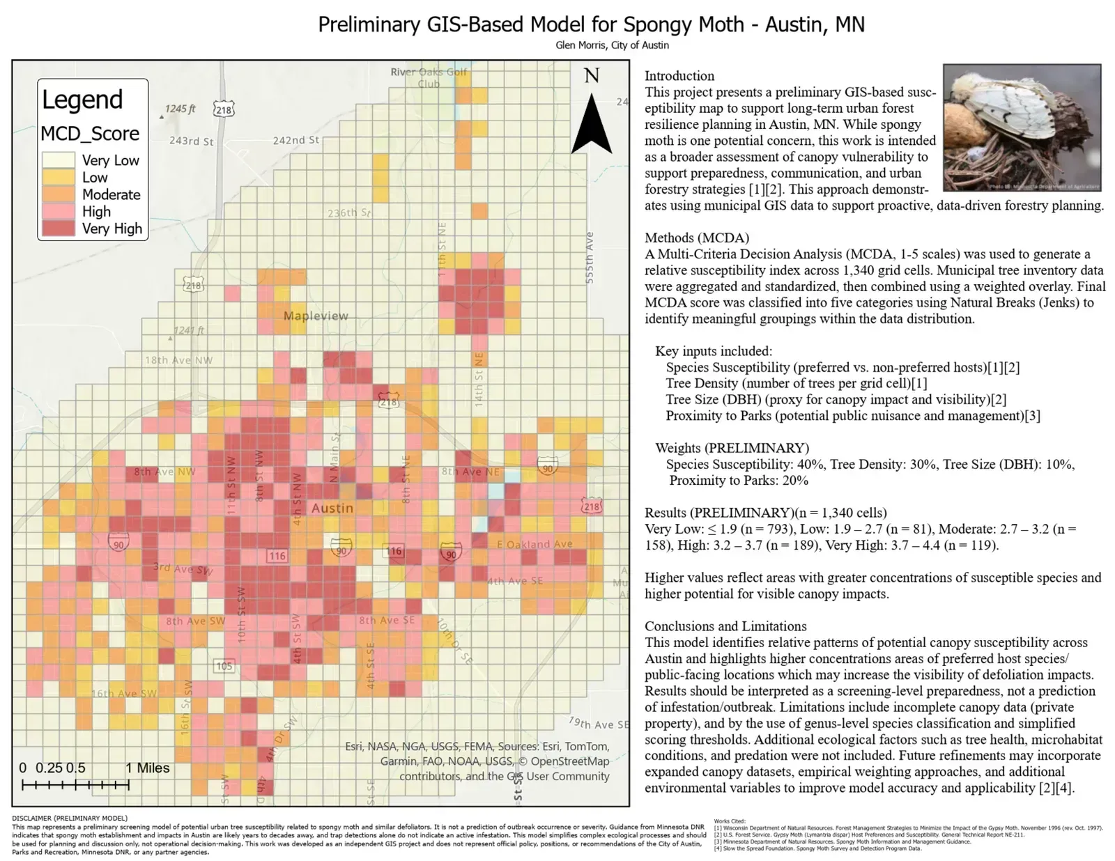
Preliminary GIS-Based Model for Spongy Moth in Austin, MN
Glen Morris (City of Austin, MN)
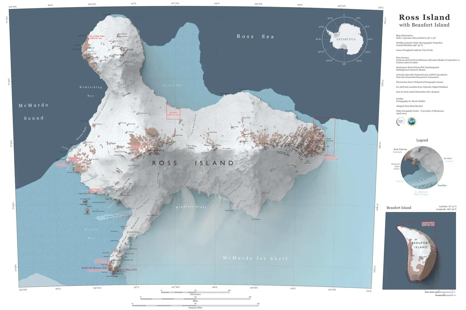
Ross Island with Beaufort Island
Nicole T Schiller (University of Minnesota)
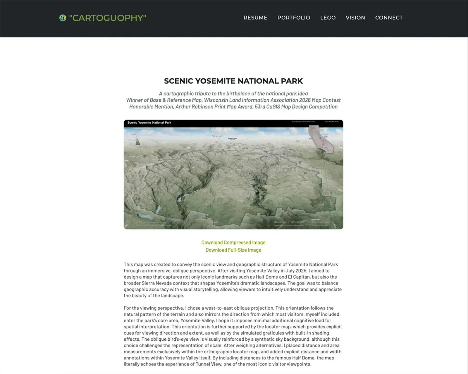
Scenic Yosemite National Park
Atlas Guo (University of Wisconsin-Madison)
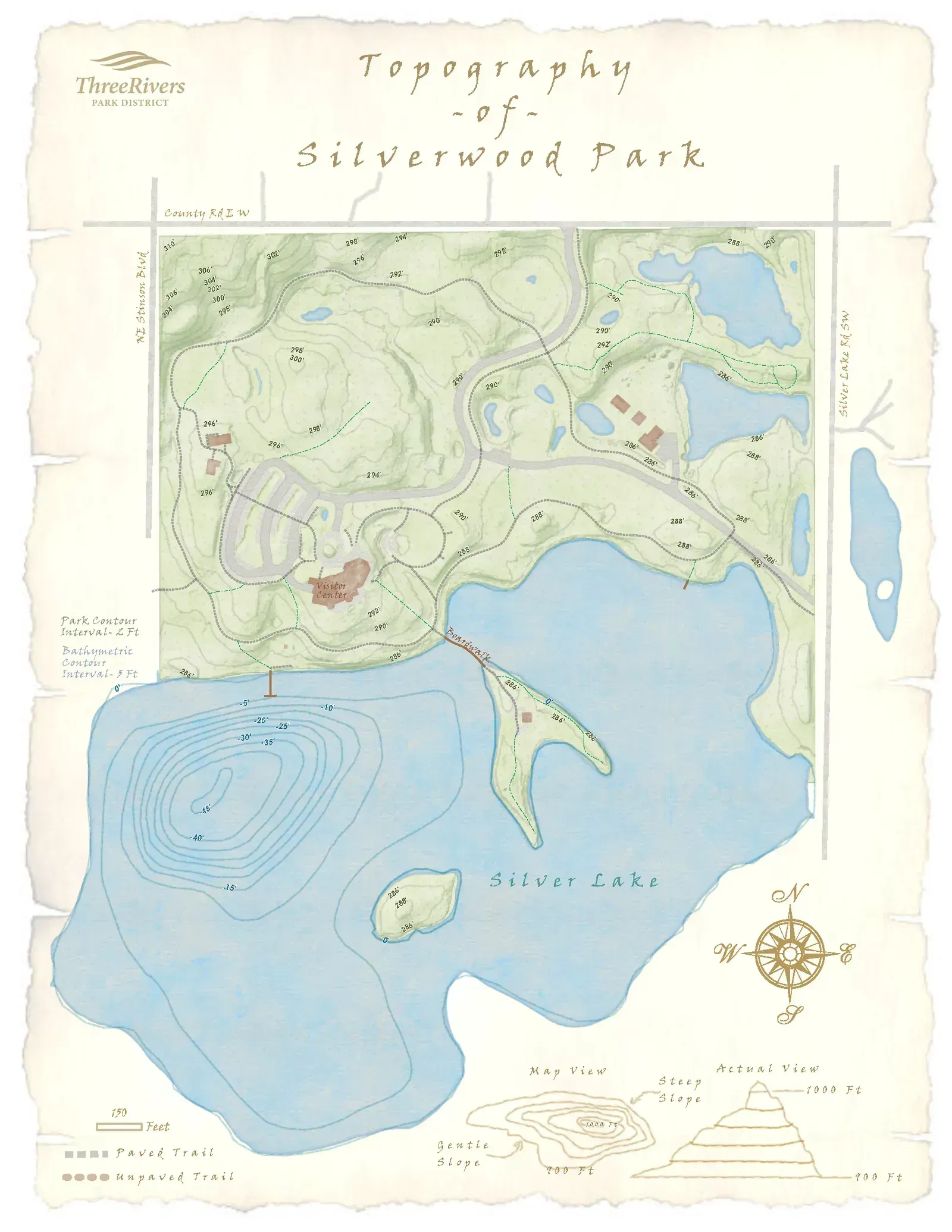
Silverwood Topographic Map
Amanda Huber (Three Rivers Park District)
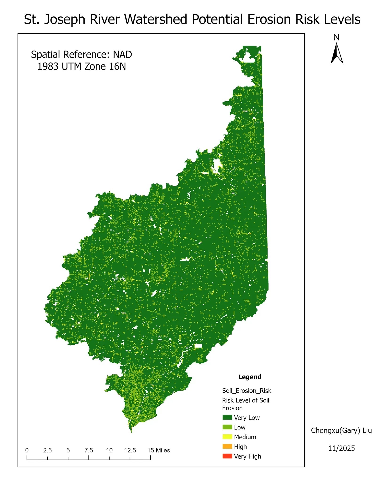
Soil Erosion Risk Distribution and Analysis in St. Joseph River Watershed
Chengxu Liu (Purdue University ); Bernard Engel, Innocensia Achieng Owuor, Nicole (Ningning) Kong (Purdue University)
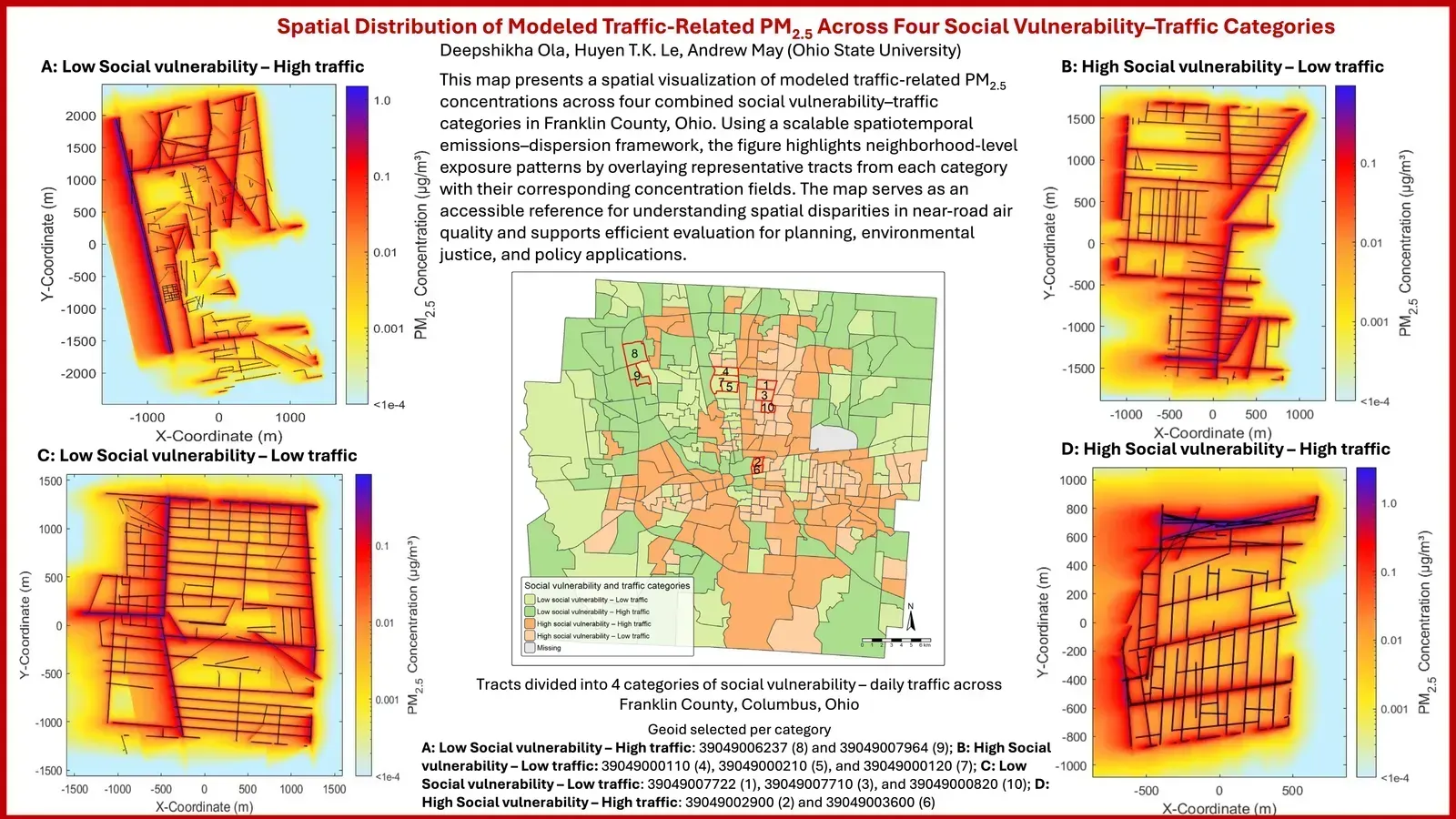
Spatial Distribution of Modeled Traffic‑Related PM2.5 Across Four Social Vulnerability–Traffic Categories
Deepshikha Ola (Ohio State University); Huyen T.K. Le; Andrew May (Ohio State University)
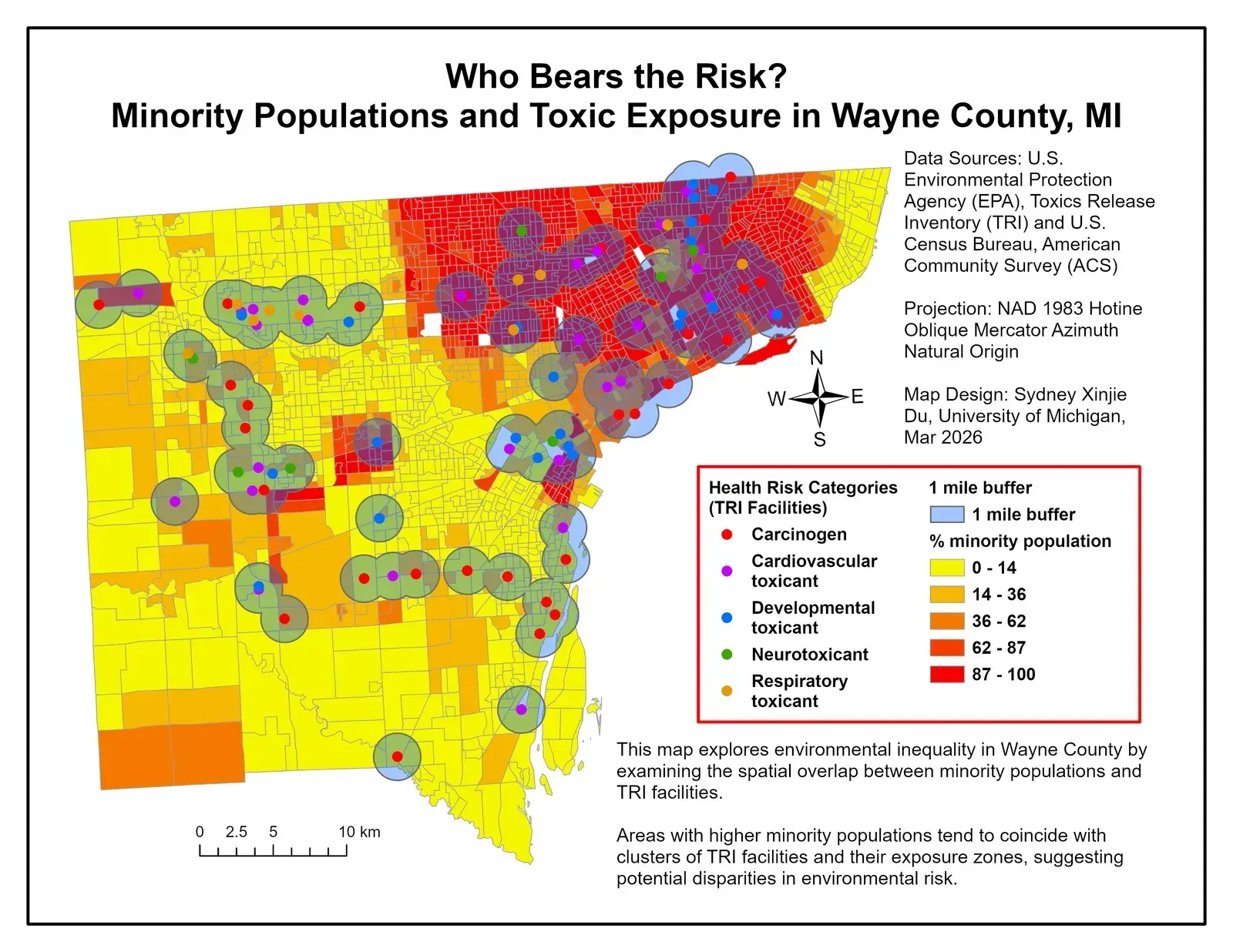
Who Bears the Risk? Minority Populations and Toxic Exposure in Wayne County, MI
Sydney Xinjie Du (University of Michigan)
* Static and interactive maps are provided "as is" based on information received from their authors and are not reviewed for quality or accuracy prior to inclusion in the gallery.