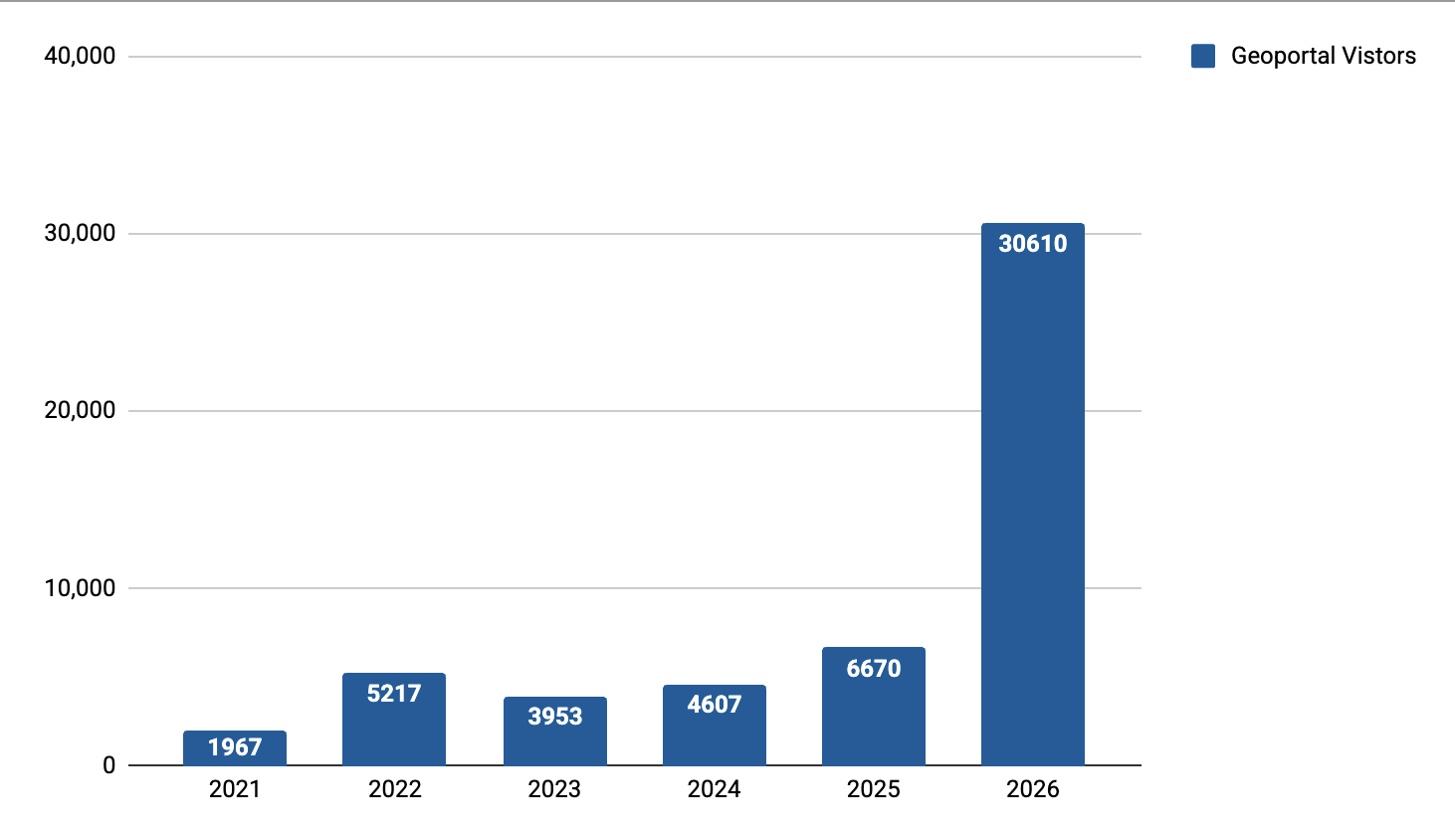
BTAA Geoportal: Rebuilt from the Ground Up
The BTAA Geoportal has relaunched, marking the biggest technical update in the program's ten-year history. Rebuilt on a new modular, API-first architecture, the redesigned Geoportal continues BTAA-GIN's commitment to making geospatial data, maps, and GIS resources easy to find and use across its 18 member institutions.
The redesign was a collaboration of Eric Larson, BTAA-GIN's lead developer, who brought the technical expertise behind the new architecture and design, and Karen Majewicz, Associate Director of Technology & Data Curation, who led project decision-making. Working together, in coordination with the Technology Committee, they rebuilt the platform from backend to frontend. To help users get the most out of the new interface, BTAA-GIN has also released a series of short video tutorials covering common search strategies, from finding historic campus maps to locating LiDAR-based land cover data.
The redesigned Geoportal debuts with a more intuitive interface, an interactive hexbin map for exploring the collection visually, and expanded filtering by date range, resource type, and geographic extent. Spotlighted collections include the Sanborn fire insurance maps, the Urban Base Layers collection, and the USDA Important Farmlands collection.
For the broader geospatial library field, the redesign offers a working example of infrastructure built for sustainability: a shared platform serving 18 institutions that can now evolve piece by piece as technology changes, rather than requiring a full migration each time.
Explore the redesigned BTAA Geoportal at geo.btaa.org.
Read more: Watch the tutorial series on YouTube @GeoBTAA
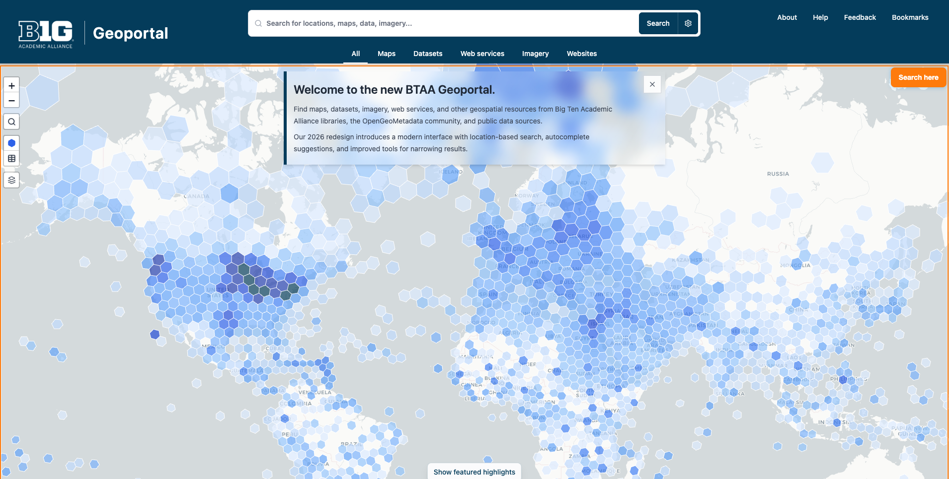
Newly redesigned BTAA Geoportal homepage as of June 2026