Collection of Historic Balkan Maps Added to the BTAA Geoportal
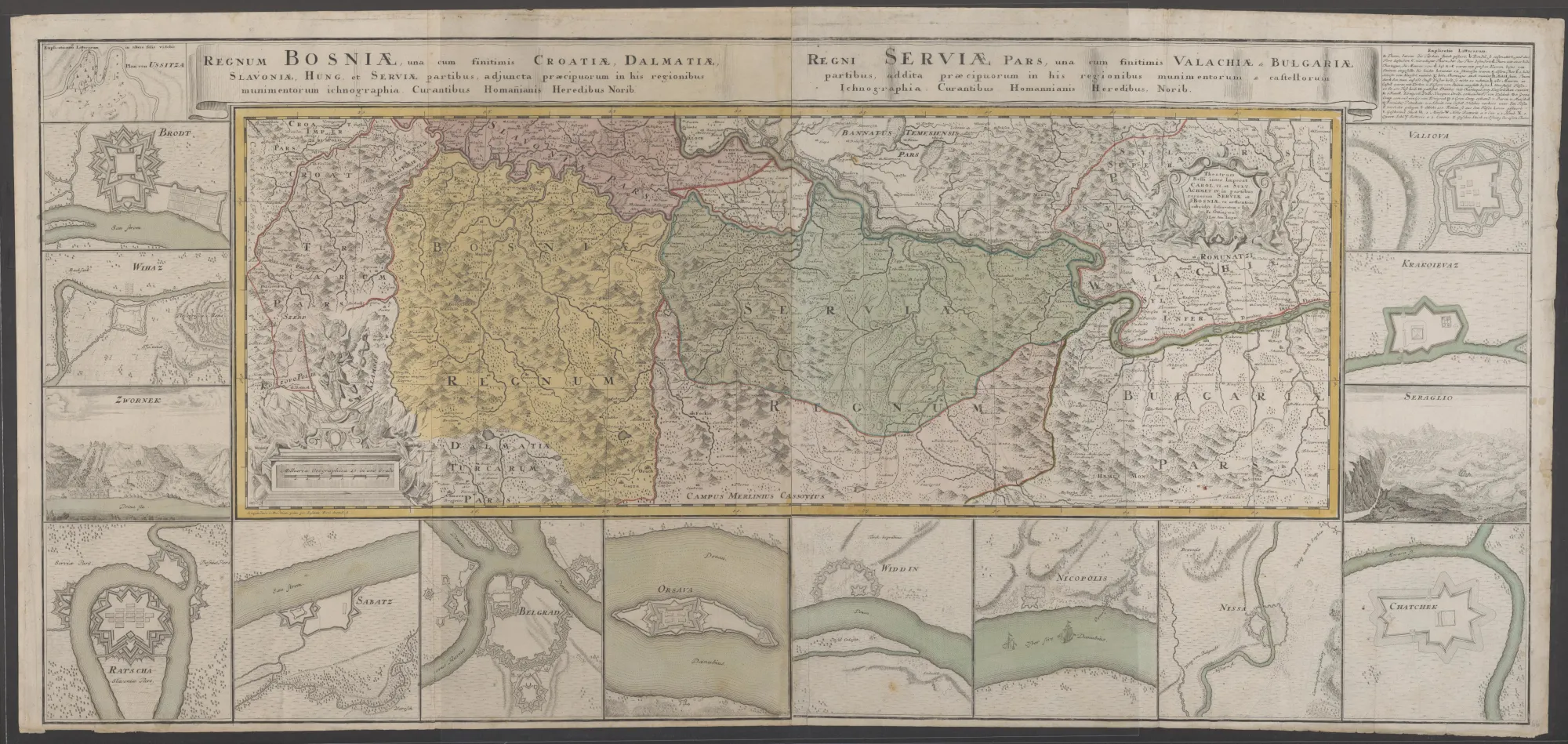
Johann Friedrich Oettinger, “Theatrum Belli Inter Imperat…in Partibus Regnorum SERVIAE et BOSNIAE,” 1739.
In the summer of 2025, the University of Michigan Library acquired the Dr. Stevo Julius Collection, consisting of over 110 historic maps and city views dated from the mid-16th to early 19th centuries, mostly of Dr. Julius’s birthplace, former Yugoslavia. The collection in its entirety was cataloged and digitized over the past year, and can now be found in the BTAA Geoportal. This collection considerably increases the Geoportal’s historic coverage of the Balkan peninsula, especially what is today Croatia, and includes works by some of the most influential early modern European cartographers, such as Abraham Ortelius, Gerard Mercator, and Vincenzo Coronelli, among others.
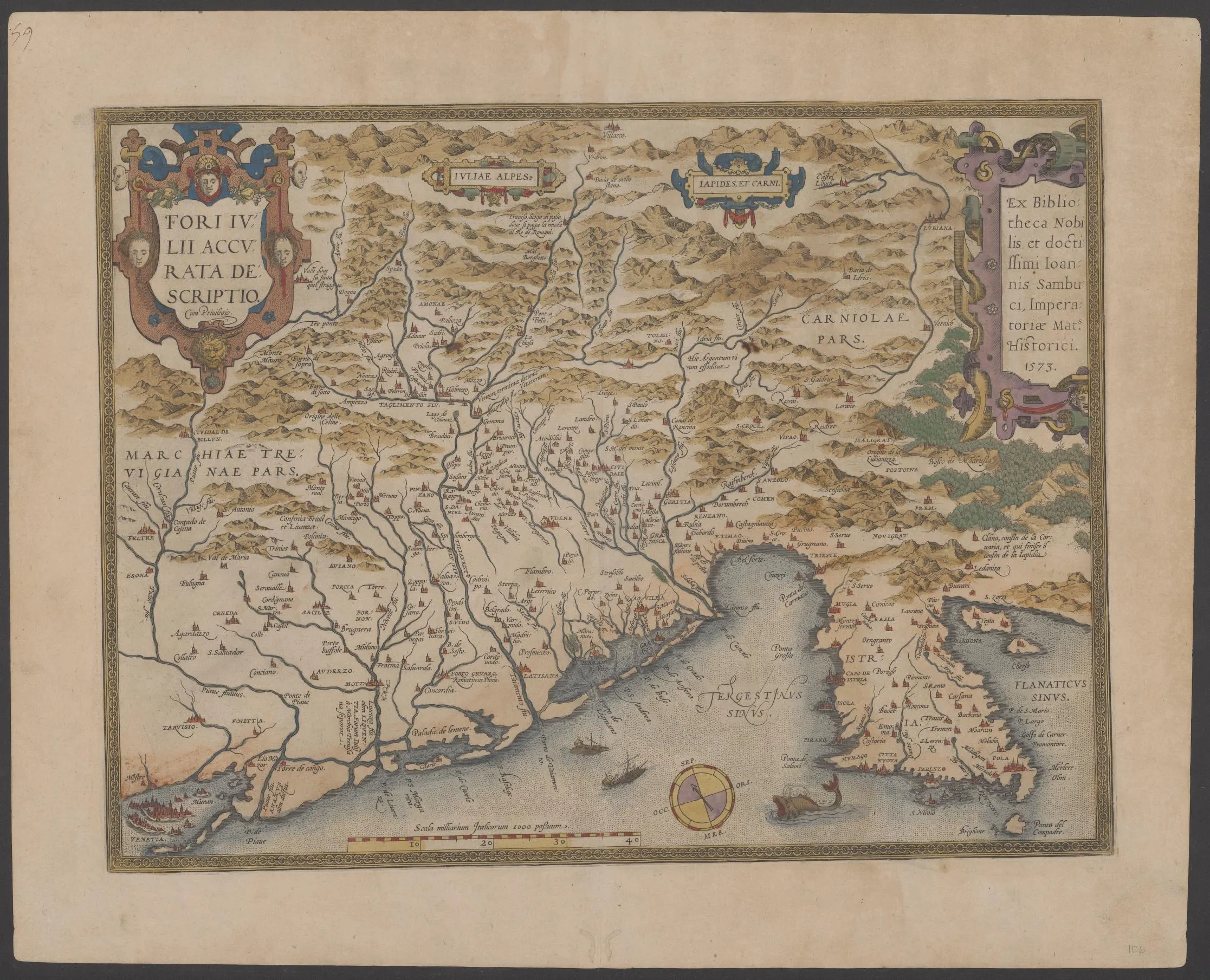
Abraham Ortelius & János Zsámboki, “Fori Julii Accurata Descriptio,”Antwerp: Christopher Plantin, 1579.
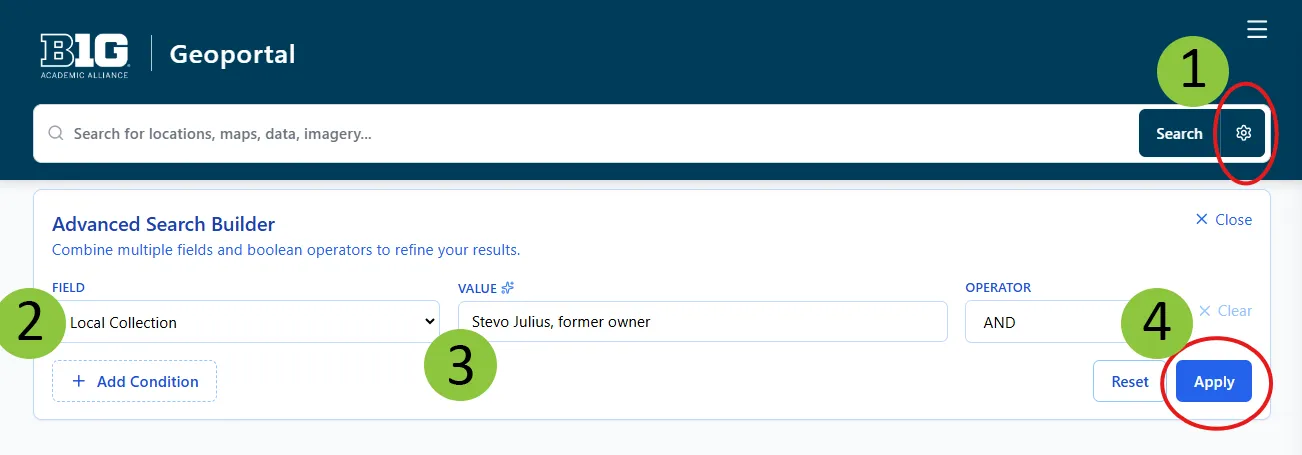
To view this historical collection for yourself, follow this link in the newly redesigned BTAA Geoportal. You can also find them by conducting an advanced search in the BTAA Geoportal where the field is “Local Collection” and the value is “Julius”.