Big Ten GIS Conference 2026: Record Attendance and a New Citation Tool
On April 17, the sixth annual Big Ten GIS Conference welcomed 340 participants for its largest attendance to date. The keynote, delivered by Frank Donnelly on the Data Rescue Project — a coordinated effort to archive government datasets at risk of being altered or removed from public access — drew consistent recognition in post-conference surveys as timely and directly relevant to the work of geospatial professionals. Other sessions on AI-assisted QGIS workflows and collaborative historical GIS methodologies rounded out a program that attendees described as reflecting both the breadth of disciplines in the field and the urgency of current challenges. One attendee wrote that they planned to apply what they learned directly to their work the following week. Another called the conference "excellent" and identified the Geoportal as a resource they planned to share with colleagues immediately. View conference recordings »https://gin.btaa.org/conference
The conference also introduced the BTAA-GIN Data Citation Generator, a tool developed to help researchers produce accurately formatted citations for geospatial datasets in APA, MLA, and Chicago styles.
Read more: Try the Data Citation Generator »
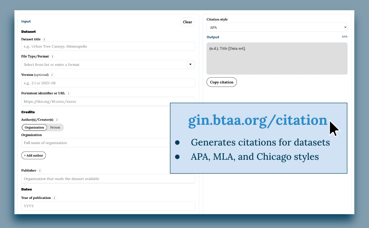
Data Citation Generation Tool
Program Activities
Committees
TECHnology
- Launch and testing timeline: lightweight online user testing in April–May; in‑person review in May; broader community feedback in June; June-July launch targeted; additional testing and promotional preparation planned through August.
- Feedback and coordination actions: committee to invite BTAA‑GIN members to provide feedback during the April Program Team meeting; structured feedback materials and user‑testing tasks will be developed; coordination with Community Engagement will continue on help pages and promotional materials.
Community Engagement
- Met twice in April to finalize plans for 2026 Big Ten GIS Conference and to debrief post-conference.
- The conference went very smoothly with record-setting attendance, a larger group of volunteers, and consistently high quality presentations that kept attendees engaged.
Knowledge
- AI Policy Working Group formed: Committee agreed on the need for a BTAA‑GIN policy focused on preventing AI crawling/scraping of the Geoportal; Danny will chair, with all members participating.
- Research updates: GIS Service Model final report published; research survey participation encouraged (seven responses so far, with committee members reminded to complete the survey).
Coordination
- Big Ten GIS Conference planning: Committee reviewed host opening remarks and conference themes for input.
- Membership updates: Heather Ross (Penn State) is joining BTAA‑GIN and will be onboarded to the Tech Committee and Priority 2.
- Operational updates: Committee reviewed Priority Working Group progress and clarified the Coordination Committee’s role in providing feedback ahead of Program Team decision‑making.
Workgroups
Workgroups
Data Citation Work Group
- Tool launched at Big Ten GIS Conference featuring a pre-recorded video demonstration by Amanda Tickner, Michigan State University. [gin.btaa.org/citation]
BTAA Geoportal
This month by the numbers
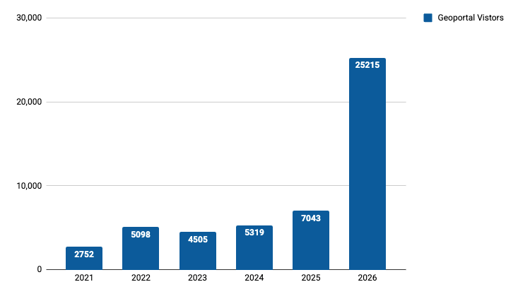
April visitors to BTAA Geoportal year-over-year
Top Google searches leading to the Geoportal
- what school district am i in
- columbus school district map
- btaa geoportal
- illinois
- traffic cameras
- milwaukee school district map
- yes
- sanborn maps
- lorain county gis
- harford county
- zoning map
- columbus school districts map
Top internal search keywords
- geology
- PLSS
- china
- sanborn
- highway roads
- kH-4a corona
- west virginia
- delta
- nova scotia
- louisians--new orleans
Collections
Total records as of May 5, 2026: 116, 681
Harvesting Activities
View current harvest operations dashboard.
Web Development
- Deployed new production server and moved official launch date to June 15. Completed frontend enhancements including autocomplete improvements, location-based search suggestions, spatial relevance scoring refinements, and Year facet redesign based on usability testing findings.