TECHnology
- Geoportal design and function reviews: Resource pages updates and new interface enhancements reflected on homepage
Cities update zoning boundaries, building footprints, and parcel lines constantly — but earlier versions are rarely retained. For researchers studying neighborhood change, housing policy, environmental exposure, or urban development, those overwritten datasets create permanent gaps in the historical record. When past versions disappear, so does the ability to understand how places evolve.
Research libraries have long been responsible for preserving access to information, and geospatial data is no exception. BTAA-GIN is extending that stewardship to municipal geodata.
In March, GIN published its Geodata Collection Curation Plan, outlining how versioned municipal datasets will be identified, accessioned, documented, and made persistently accessible. The plan builds on BTAA-GIN's paper, "Ephemeral Geodata: An Impending Digital Dark Age," which received the Journal of Map & Geography Libraries Best Paper of the Year Award in 2024.
BTAA-GIN is now applying this approach through partnerships with several cities, including Minneapolis, Columbus, Baltimore, and Philadelphia. A recently published case study with Philadelphia's CityGeo division illustrates the model in practice and demonstrates how libraries and municipalities can collaborate to preserve geospatial history for future scholarship.
Read more: Read the case study
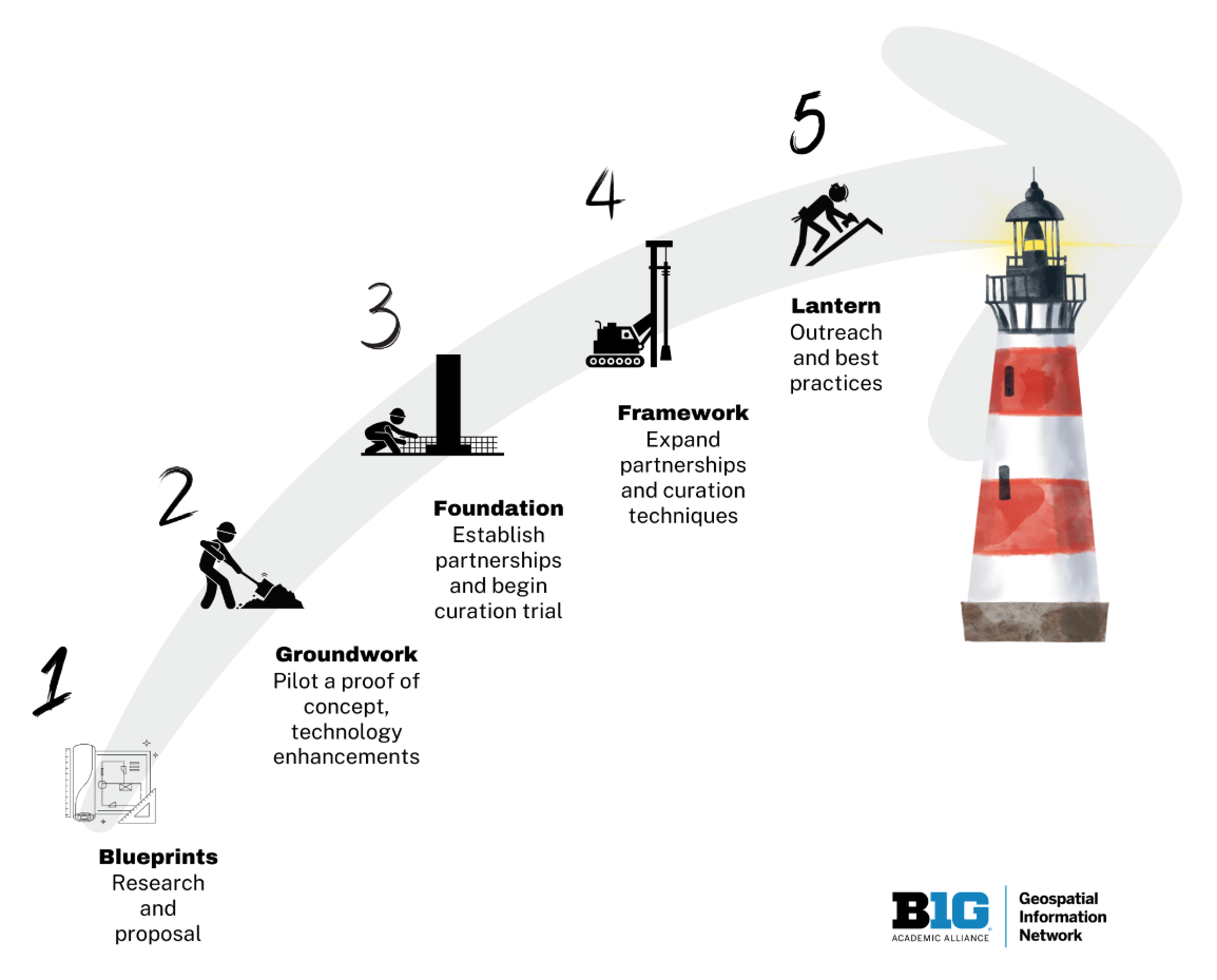
BTAA-GIN Geodata Collection Strategic Plan 2023-2027
TECHnology
Community Engagement
Knowledge
Coordination
Workgroups
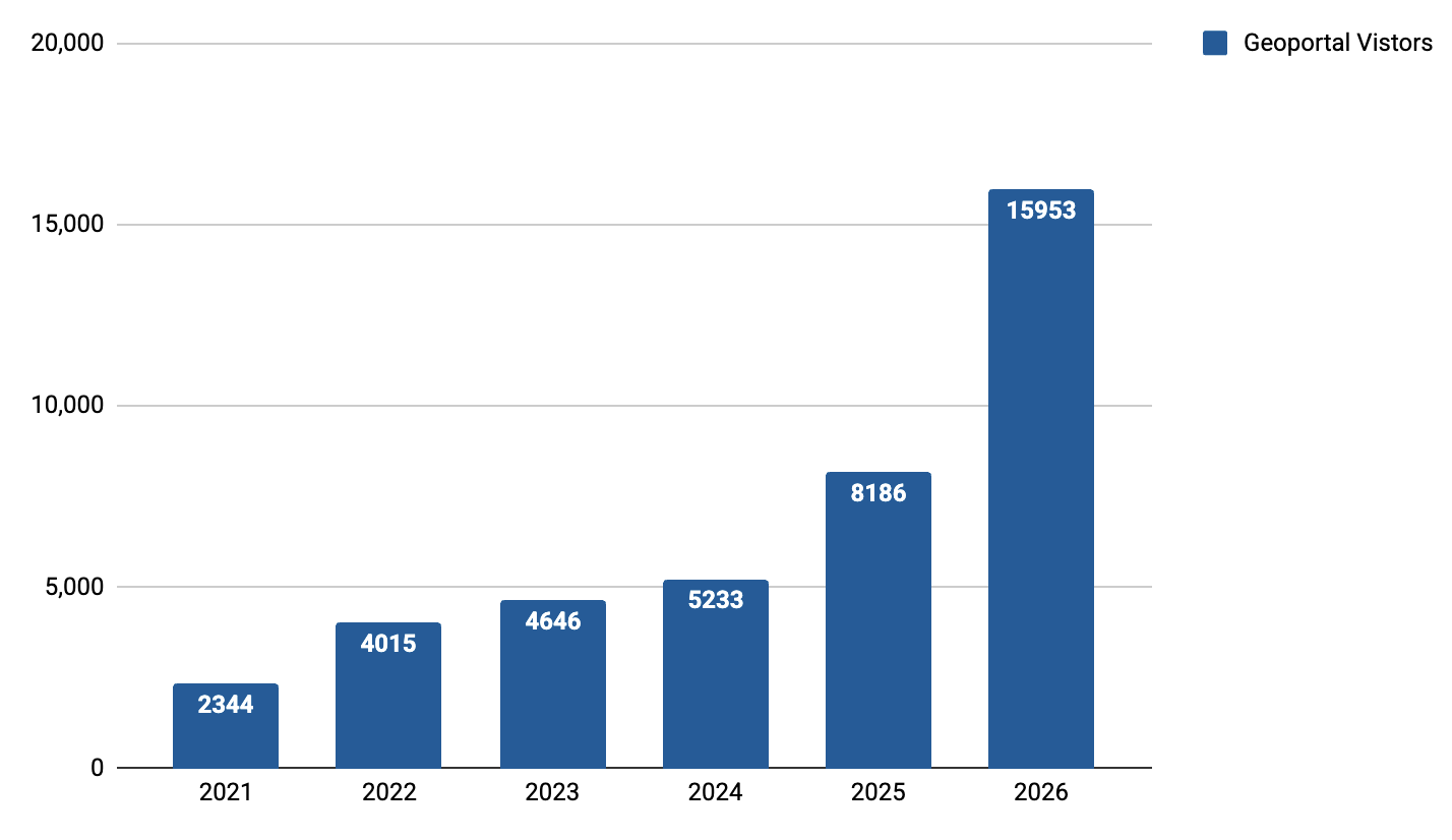
Total records as of March 2026: 116,498
View current harvest operations dashboard.