Find Maps
Note for Instructors
This basic tutorial is designed for any course in which students need to locate a map on a given topic and insert it into a document. It is designed to not go beyond that level - the maps in this case are being used in a very basic and illustrative manner. No GIS is required. A sample assignment is also shared.
Learning Objectives
Section titled “Learning Objectives”Through completing this tutorial, students will:
- Be able to locate a map on a needed topic in the BTAA Geoportal.
- Be able to download or copy a given map’s image.
- Be able to insert a map into a given document.
- Understand basic fair use and copyright implications for using maps in content.
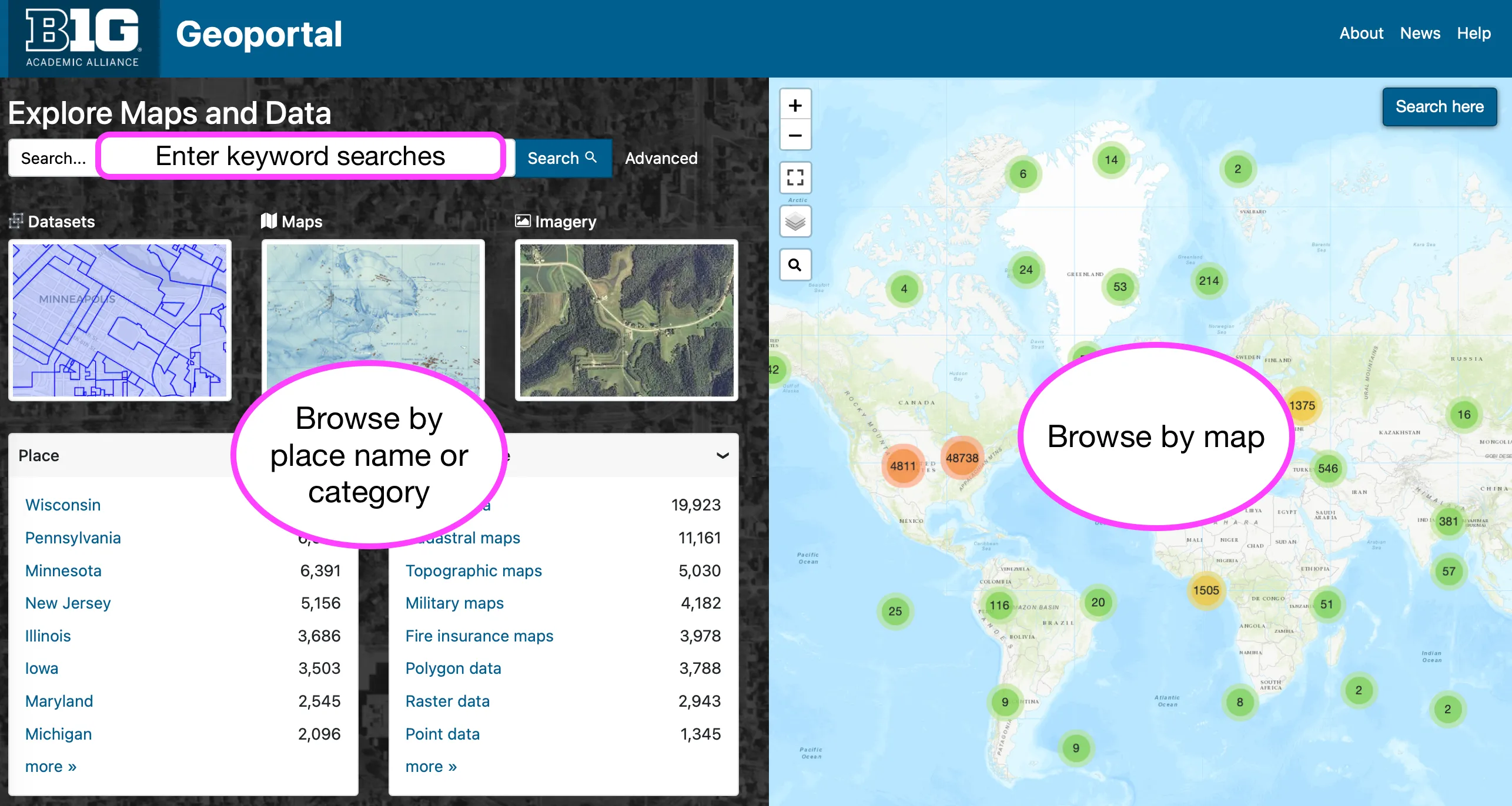
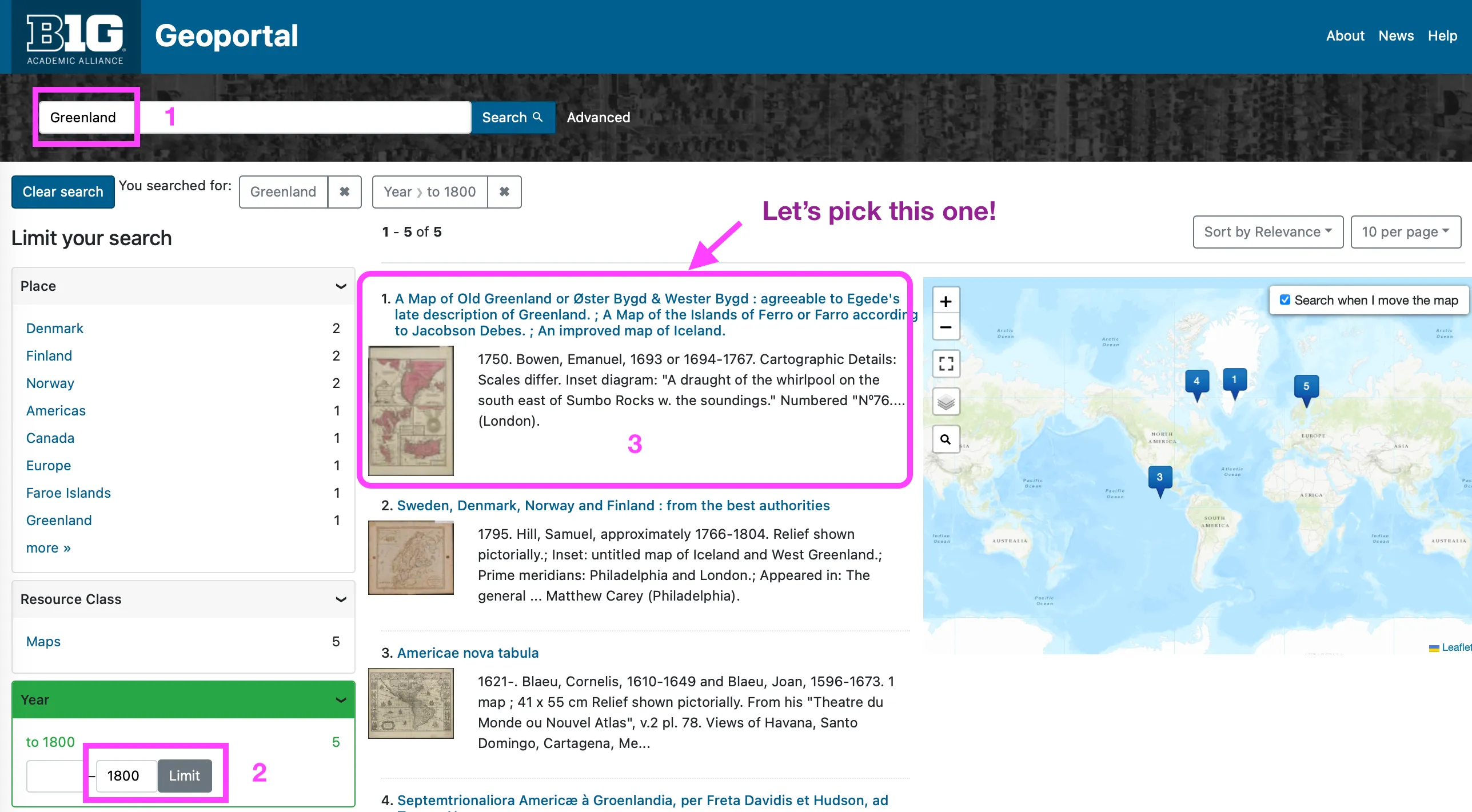
Searching the BTAA Geoportal
Section titled “Searching the BTAA Geoportal”Refining and interpreting results
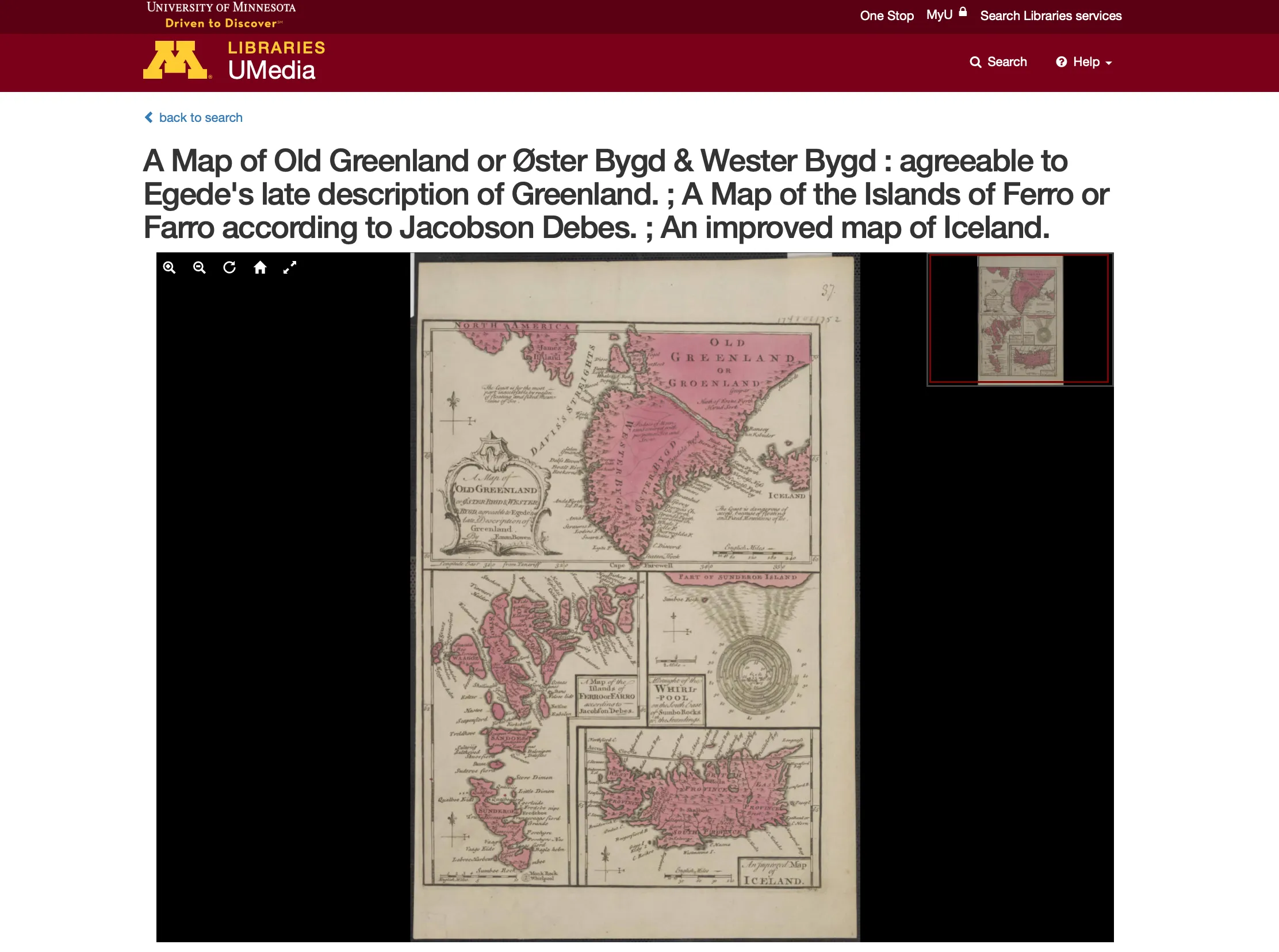
Section titled “Refining and interpreting results”This section walks the user through finding a map of Greenland.
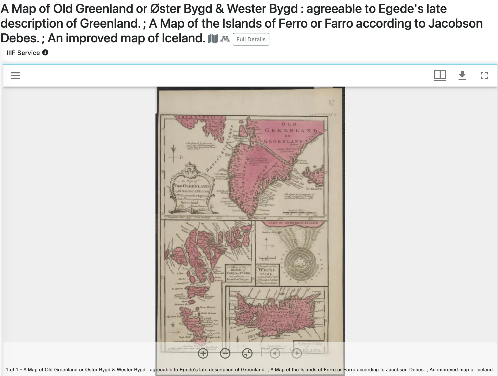
Downloading and placing images
Section titled “Downloading and placing images”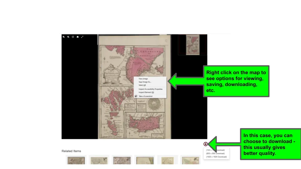
Placing images in a document
Section titled “Placing images in a document¶”Place in document (Word, PowerPoint, Google Document, Google Slides, etc.) like you would any other image. If you right clicked and copied, then right click and paste. If you saved, insert and find where you placed the file, then choose the file.
Resizing images
Section titled “Resizing images¶”It will very likely need to be resized. Most tools will allow you to do this manually by clicking on the image and then choosing one of the corners to resize. You can also crop, if desired.
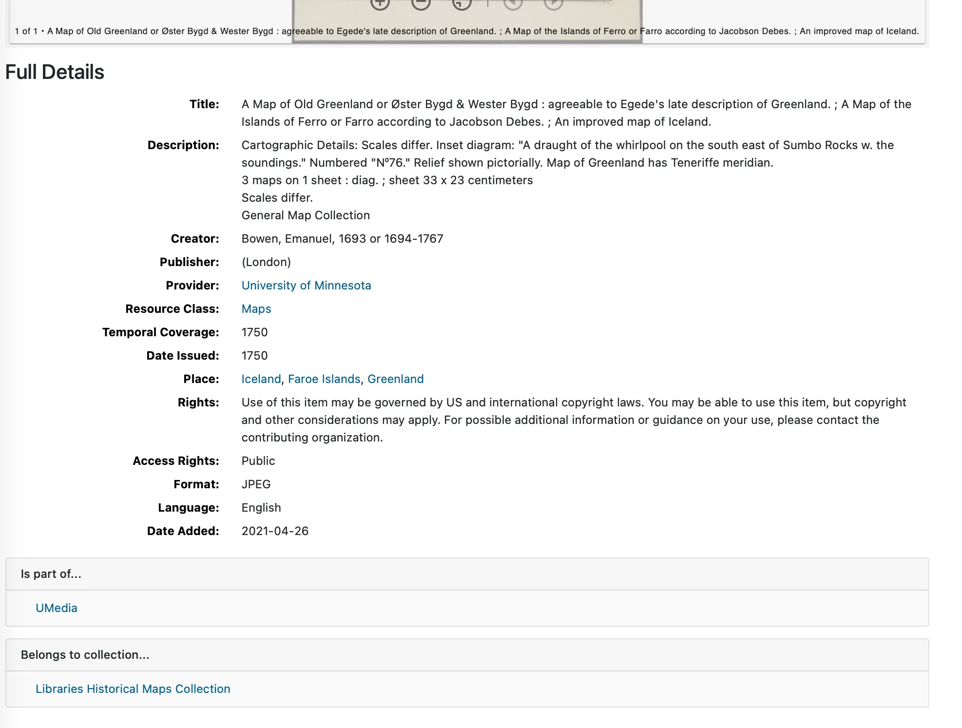
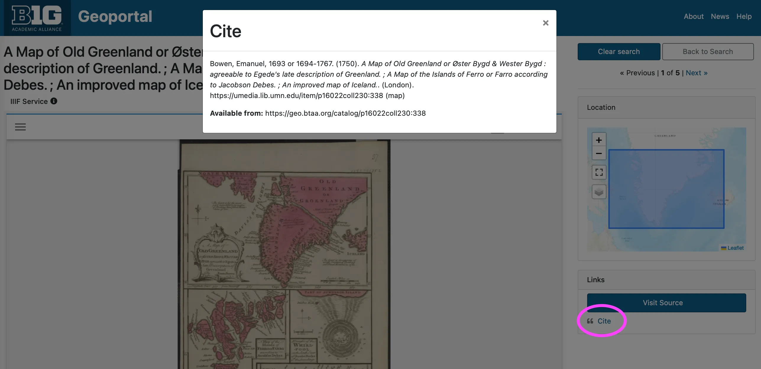
Captioning and citing images
Section titled “Captioning and citing images¶”Be sure to caption the image to indicate what it is. Also, you will want to cite the image, indicating whetee you got it from. The Geoportal provides a cite option for items, but you may need to adapt to the citation style required by your instructor.
Copyright and fair use
Section titled “Copyright and fair use”Here is a 5¢ tour of determining whether you can use an image. However, you should ask your instructor or librarian questions to be sure your use is okay.
Even if the ORIGINAL is older (such as our 1750 map example), the scan of the item may be covered by copyright. Assume all images online are copyrighted unless:
- It is from a FEDERAL US Government source (items from state and local government sources may be copyrighted)
- There is another statement of rights, such as a Creative Commons license.
So, can you use it?
Generally, if you are using it just in a class presentation or in an assignment submitted to your instructor, your use of the map would likely be considered fair use and acceptable. If your content is posted online for wider distribution, such as in a journal article or electronic thesis, this would NOT be considered fair use and you likely cannot use a copyrighted image without seeking permission from whoever owns the image.
More Resources
Section titled “More Resources”Other places to find historical maps
Section titled “Other places to find historical maps”Video walkthroughs of placing images
Section titled “Video walkthroughs of placing images”- How to Add Images to Google Slides
- Google Docs: Inserting Images
- PowerPoint: Inserting Pictures
- Word: Pictures and Text Wrapping
Resources on copyright/fair use
Section titled “Resources on copyright/fair use”- Copyright Services (Ohio State)
- Copyright and fair use for images (Ohio Wesleyan)
- Image Copyright (Duke)
Exercise
Section titled “Exercise”Instructor:
- Set up a Google Slides deck with a slide with each student’s name.
- Make slides editable and share link with students.
Students:
- Go to the BTAA Geoportal.
- Find a map from a polar area (Greenland, Antarctica, Northern Scandinavia, etc.) of interest to you.
- Download or copy image from its original source (not the Geoportal thumbnail)
- Insert it into the slide with your name on it.
- Caption it.
- Provide the citation from the Geoportal.