Fire insurance maps are detailed city plans originally created to evaluate fire risk. They depict building footprints, construction materials, and property uses, along with street layouts and property lines. These maps offer a unique, granular snapshot of urban neighborhoods as they existed in the 19th and 20th centuries.
The Sanborn Map Company produced the majority of fire insurance maps, but other publisher names include Perris, Hexamer, Whipple, Baist, Bromley, or Hopkins.
Because they are a popular research resource, fire insurance maps have been scanned and made available in a variety of ways, some under commercial license provided by a library purchase or subscription. There is no single resource that has all the maps in one location.
This guide provides a suggested path for finding a Sanborn Map.
If a general search doesn’t yield results, you can browse specific collections. These collections, contributed by BTAA member libraries and partners, are organized by the state they cover.
IllinoisThis collection from the University of Illinois contains maps that pre-date 1923.
IndianaThis collection from Indiana University contains over 10,000 maps of Indiana cities and towns, dating from the 1880s to 1925.
New JerseyThis collection from Princeton University covers the state of New Jersey for the period between the 1880s and 1924.
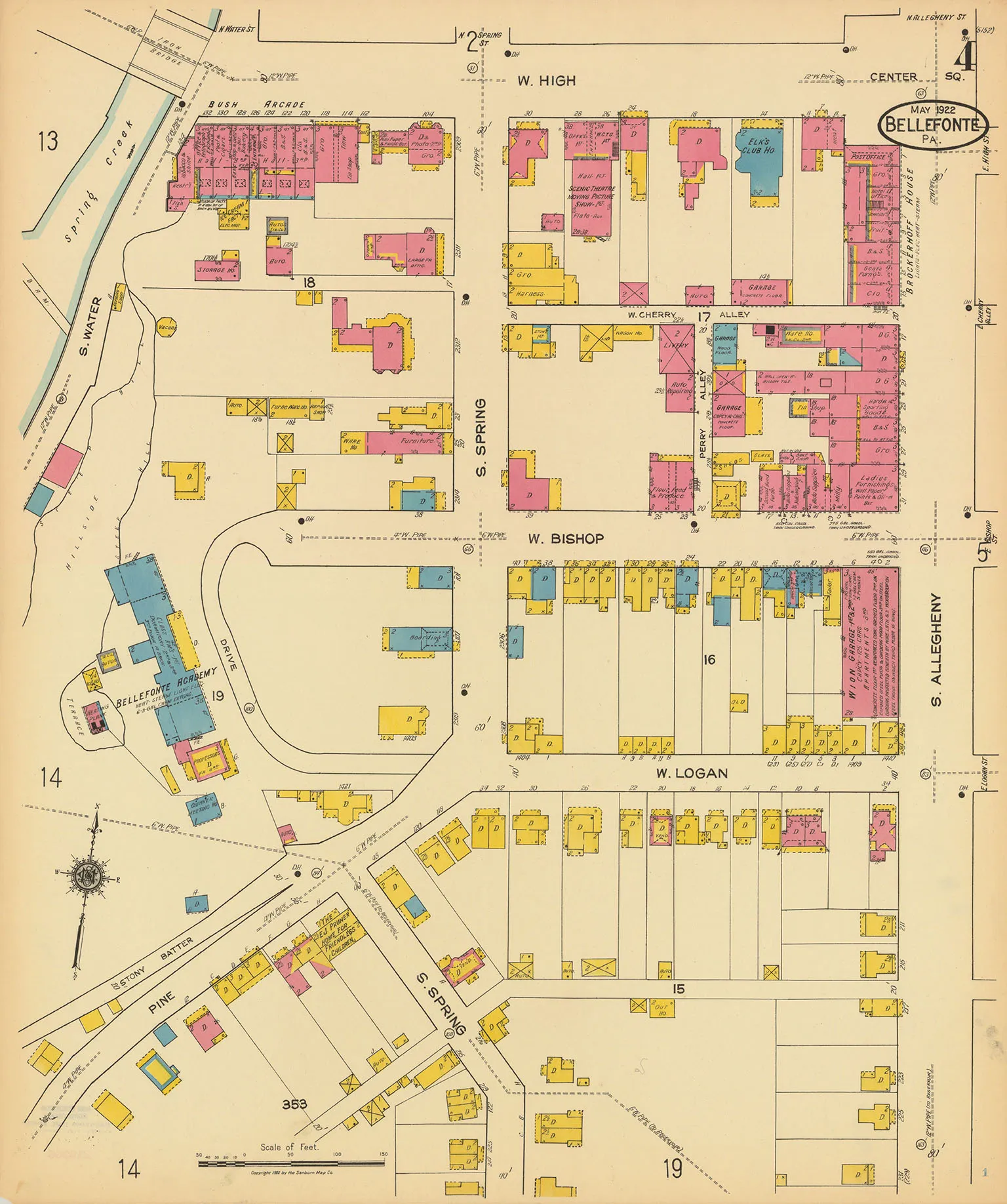
PennsylvaniaPenn State University has a near-complete collection of Sanborn maps for Pennsylvania. For items not yet in the Geoportal, the full collection can also be accessed directly at the Penn State University Libraries website.
Microfilm Collections Many libraries hold Sanborn maps on microfilm. These are typically black and white and may be available via Interlibrary Loan. Contact your institution’s library for assistance.
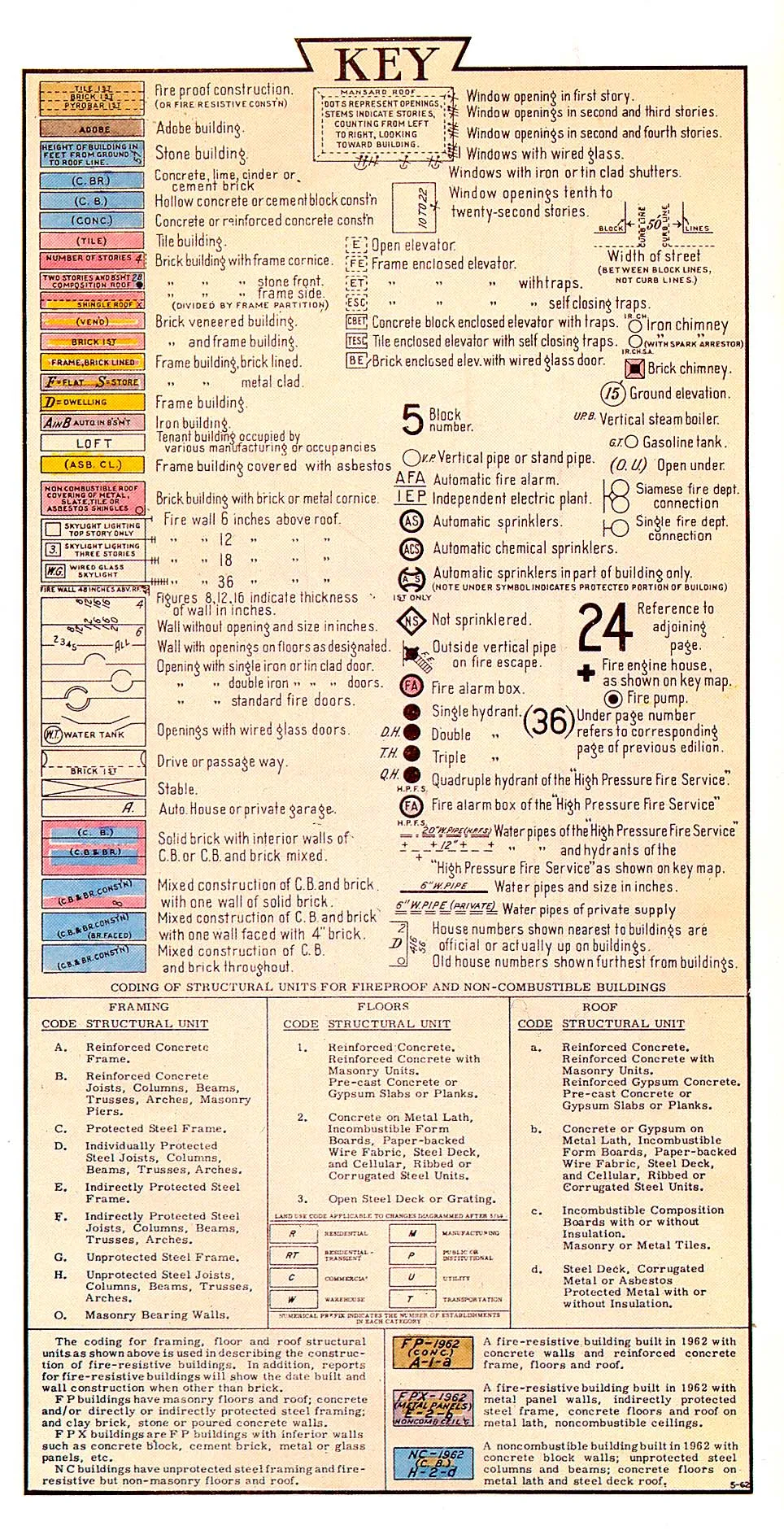
Each city coverage begins with a graphic index to guide the user to the correct page with each page only covering a few blocks. The original paper maps used color to indicate building materials such as yellow for wood construction and pink for brick. Some newer maps have “paste on” updates or corrections applied to a base map. Note the correction record on the index key page for dates. While Sanborn maps do not show property owner names, they can show business names. For more information, see the Library of Congress’ Introduction to the Sanborn Collection.
This excellent tutorial from the Kansas City Public Library gives a quick history of the maps and explains how to use the indexes, keys, and colors. How to Use Sanborn Fire Insurance Maps