Big Ten GIS Conference Returns in April
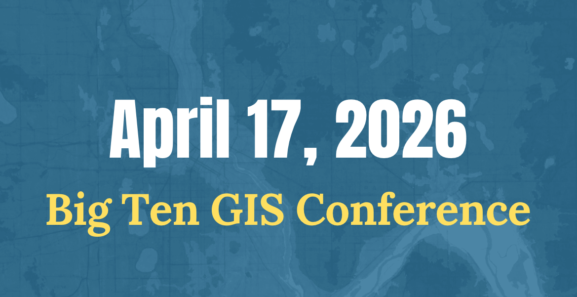
Registration is now open for the sixth annual Big Ten GIS Conference, to be held virtually in April. This year's keynote will be delivered by Frank Donnelly, Head of GIS and Data Services at Brown University Library and coordinator of GeoData@SciLi. Donnelly is a specialist in U.S. census and government data and a contributor to the Data Rescue Project.
Launched in February 2025, the Data Rescue Project is a coordinated effort among members of IASSIST, RDAP, and the Data Curation Network. It mobilizes volunteers to archive government datasets at risk of being altered or removed from public access. The work reflects a challenge central to geospatial library programs: ensuring that authoritative data remains findable, accessible, and usable over time. The BTAA-GIN has contributed by saving backup copies of geospatial data from several federal government data portals.
Read more: Join us by registering now »
Program Activities
Committees
TECHnology
- Status report on Geoportal development work
- Discussed collection level pages requirements and opportunities
Community Engagement
- Reviewed the first draft of the BTAA-GIN Outreach Toolkit and discussed strategies for leveraging member professional networks to expand program engagement.
- Advanced planning for upcoming Collection Stories blog content, including posts on the Maps in the Wild project, an Urban Base Layers city case study, and a forward-looking editorial schedule.
- Received updates from the Conference Planning Committee on preparations for the sixth annual Big Ten GIS Conference.
Knowledge
- Discussed the Knowledge Committee’s role in supporting the BTAA‑GIN Strategic Priorities and reviewed member participation across priority groups.
- Received updates from the Conference Planning, Service Models, and Data Citation work groups and provided feedback on areas where committee input was requested.
Coordination
- Report outs on conference planning, outreach toolkit, priority working groups, and fellowship research.
- Discussed considerations for an updated Impact Report (2025)
Workgroups
Workgroups
Geodata Curation Workgroup
- Finalized the Curation Plan for publication.
- Concluded the work group and set plans to transition to a city‑cohort approach.
Data Citation Workgroup
- Shared a demo of the tool at the Program Team meeting and launched a survey to gather feedback.
BTAA Geoportal
This month by the numbers
Top Google searches leading to the Geoportal
- franklin county school district map
- btaa geoportal
- illinois traffic cameras
- milwaukee school district map
- harford county gis
- michigan fuelwood map pdf
- idot cameras
- active coal mines in indiana
- franklin county ohio school district map
- global active archive of large flood events
Top internal search keywords
- Sanborn
- Cook county
- Pennsylvania
- Aswan
- Ohio
- Geology
- Bangladesh
- Ethiopia
- Pottstown
- Tioga
Collections
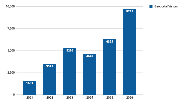
Total records as of March 1, 2026: 115,213
Harvesting Activities
| Title | Records added | Records retired |
| Illinois Geospatial Data Clearinghouse Q1 2026 | 0 | 0 |
| 2026-01-27 Scan ArcGIS Hubs | 5 | 0 |
| 2026-02-03 Scan ArcGIS Hubs | 115 | 49 |
| 2026-02-17 Scan ArcGIS Hubs | 312 | 133 |
| Reharvest edu.wisc Commit 4754813 | 12 | 0 |
| Reharvest edu.wisc Commit 929cc06 | 3 | 184 |
| reharvest edu.wisc Commit 9db8499 | 34 | 0 |
| Reharvest edu.wisc commit c036455 | 24 | 0 |
| Socrata Harvest Feb 2026 | 0 | 0 |
Web Development
- Fixed issue with the Geoportal homepage not appearing in search engine results
- Enhanced the work-in-progress development geoportal site with hexagon-based heat map, additional citation formats, and homepage design featuring highlighted collections and search entry points.