TECHnology
- Reviewed Geoportal 2.0 updates, discussed list of fixture records, and prioritized feature requirements
- Shared an overview of APIs to support shared understanding
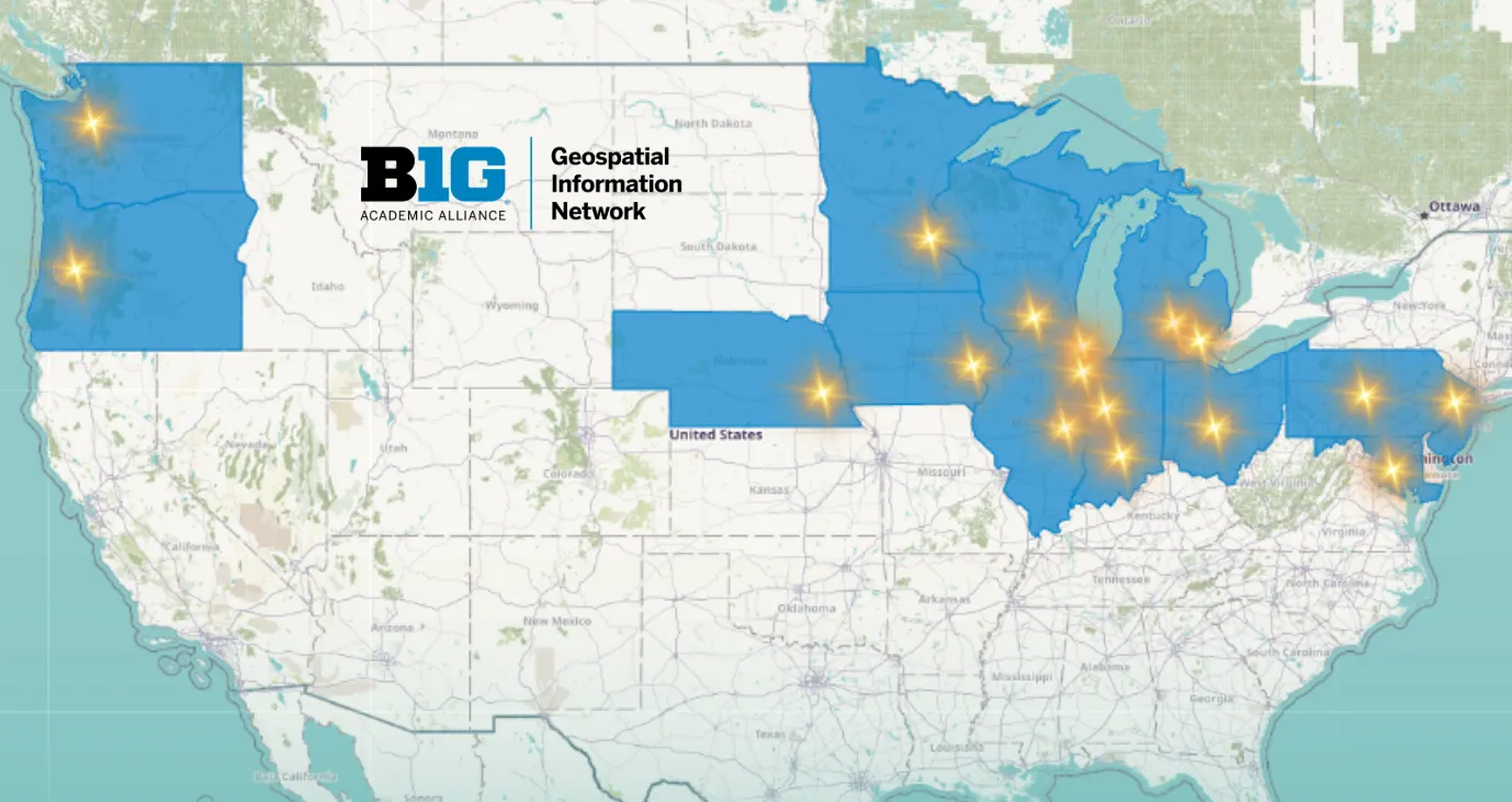
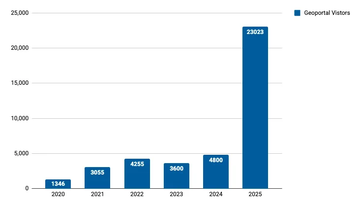
In 2025, the Big Ten Academic Alliance Geospatial Information Network marked its tenth year with significant progress across all core programs. Our flagship service, the BTAA Geoportal, continued to grow, surpassing 114,000 records now available to researchers and the public. We also welcomed two new member institutions—Washington and Oregon—through a newly developed onboarding process.
This growth brought new demands on our technology. We published the BTAA-GIN Technology Strategic Plan (2025–2026) and tested its direction through a prototype for a more flexible, future-ready Geoportal architecture. At the same time, the BTAA-GIN Geodata Collection Program reached a major milestone, transitioning from internal prototyping to real-world implementation. We established a clear Urban Base Layers curation vision, formed new data partnerships, published datasets from multiple cities, and refined our technical workflows.
The fifth annual Big Ten GIS Conference set new records for both registration and attendance, reflecting the Big Ten’s growing influence across geospatial research, tools, and techniques.
The year concluded with BTAA-GIN’s first in-person Strategic Planning Retreat in seven years. Colleagues came together to reflect on a decade of progress, align on shared priorities, and chart a clear path toward 2028—building on the collaborative foundation that has sustained this work.
TECHnology
Community Engagement
Knowledge
Coordination
Total records as of January 1, 2025: 114,895
| Task | Records added | Records retired |
|---|---|---|
| Umedia Reharvest for maps added October 2025 | 119 | 0 |
| 2025-12-02 Scan ArcGIS Hubs | 60 | 2008 |
| 2025-12-09 Scan ArcGIS Hubs | 493 | 694 |
| Reharvest Dec 2025 WisconsinView | 56 | 1123 |
| Review 06b-26081 | 0 | 47 |
| Total | 728 | 3827 |