Skip to content

June 2025 Program Update

Reimagining Community and Technology in Geospatial Libraries

Geo4LibCamp 2025 attendees in Minneapolis

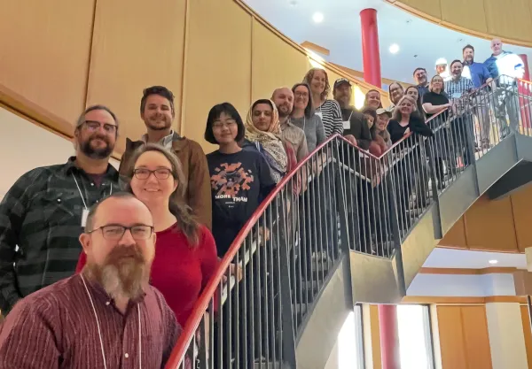
The event centered on key questions: Who is this community for? How should it evolve? And how do we better support geospatial librarians and adjacent roles? The answer: broaden participation and build sustainability from the ground up.

Key Highlights

  • launched a plan to rebrand the GeoBlacklight community as Geo4Lib, reflecting wider participation across libraries, archives, museums, academia, and industry
  • affirmed Geo4LibCamp as a learning hub with hands-on workshops, lightning talks, and collaborative sessions
  • explored scalable, low-maintenance alternatives to traditional geoportals, including modular APIs and static site deployments—with a focus on data archiving, system resilience, and long-term sustainability
  • discussed AI-powered search, multilingual discovery, and LLM-generated metadata, alongside efforts to improve accessibility, onboarding, and usability for all user levels
  • showcased Mapping Prejudice, highlighting how geospatial tools can uncover and address racial covenants in housing—advancing historical research and racial justice
  • demonstrated AllMaps, a platform that connects historical maps with modern spatial data to support cultural heritage and archival research
  • emphasized inclusive governance through rotating leadership, quarterly topical meetings, and cross-community collaboration

Community Engagement

The group dedicated most of the meeting to reviewing the published tutorials on the BTAA-GIN website and suggesting updates to improve clarity and usefulness.

Coordination

The July Coordinating Committee and Program Team meeting was canceled due to vacations.

Knowledge

Final meeting was canceled. Working asynchronously to complete the transition document for the incoming co-chairs and members.

TECHnology

Met to note what has been completed (i.e., updated policy & disclaimer, place names, etc.), wrap up current work, and brainstorm what the Committee might work on next.

  • Held kick-off meeting for the Foundation Phase of the BTAA-GIN Geodata Collection initiative by aligning on scope, priorities, roles, and next steps.
  • Coordinated section assignments for the GIS Service Model report, with members drafting content, identifying key takeaways, and preparing for an editorial review and executive summary, aiming for a full draft by the end of June.
  • Did not meet

Unique visitors by month Geoportal visitors in June 2025.

Top Google searches leading to the Geoportal

Section titled “Top Google searches leading to the Geoportal”
  • btaa geoportal
  • sanborn maps
  • oakland county mi parcel search
  • franklin county ohio school district map
  • franklin county line map
  • fire insurance maps california
  • geoportal
  • purdue campus map
  • oakland county parcel viewer
  • Sanborn
  • soil
  • geology
  • aerial photos
  • ukraine

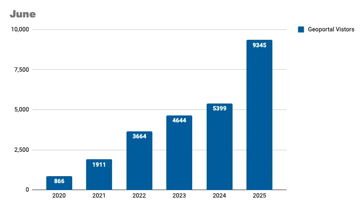
Total records as of July 1, 2025: 106,669

TitleRecords AddedRecords Retired
05a-01 MN Geospatial Commons June 202506
Create website record for Corvallis OR10
2025-06-03 Scan ArcGIS Hubs427126
2025-06-10 Scan ArcGIS Hubs169165
2025-06-24 Scan ArcGIS Hubs104122
Reharvest all edu.wisc OGM75805
Total7761224
  • Upgraded our servers to Ubuntu 24.04 for long term support
  • Added new Time Period buckets 2020-2024; 2025-present
  • Enable publication state to be changed via CSV imports