We are pleased to announce that Northwestern University has become a member of the Big Ten Academic Alliance Geospatial Information Network (BTAA-GIN). This addition to our network signifies a notable development in our efforts to enhance the collective resources and expertise available to our members.
New Team Members from Northwestern University: We welcome Méch Frazier, GIS Specialist, and Kelsey James Rydland, Head of Digital Scholarship & Research Data Management, from Northwestern University.
Network Expansion: With the addition of Northwestern University, the BTAA-GIN now comprises 15 participating institutions. This expansion underscores the network’s commitment to supporting geospatial research and education across the entire BTAA.
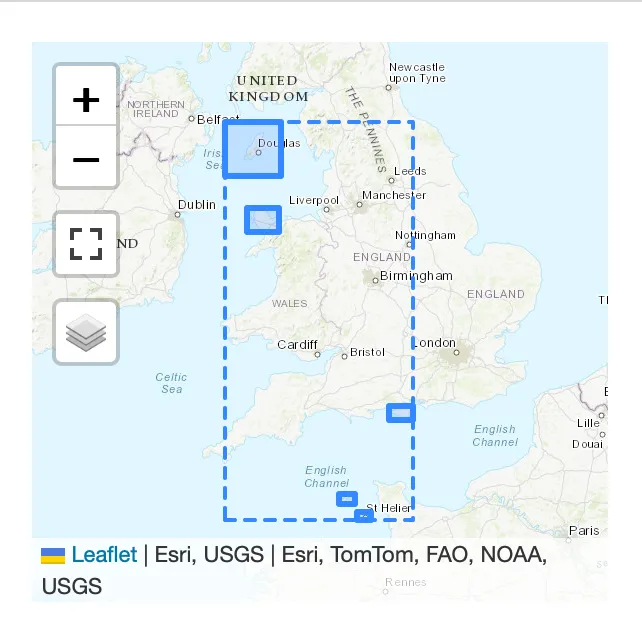
Updated Participant Map: Our participant map has been updated by team member Jay Bowen to include Northwestern University.
Contribution of Scanned Maps: Northwestern University has contributed 250 scanned maps from their Digital Collections to the BTAA Geoportal. These contributions are from their “16th-Early 20th Century Maps of Africa” and “Maps and Atlases” collections. These maps are now accessible through the BTAA-GIN portal here.
We held the first iteration of our revamped monthly Team Meetings that included a lightning presentation, round robin sharing, and discussions.
We consulted with University of Minnesota library leadership about creating a new position that would be responsible for program & outreach coordination.
We started a Technology Roadmap for the calendar year 2024 to prioritize our needs for a geodata collection pilot.
We added a facet to filter maps that have been georeferenced.
We updated the display of complex geometries in the location inset. Now, the rectangular bounding box appears as a dotted line, with the item exent as a solid polygon.