Municipal open data portals are dynamic by design. Parcels are updated, zoning changes are reflected, and infrastructure layers evolve. Yet as cities publish current data, earlier versions often disappear. For researchers studying neighborhood change, environmental exposure, housing policy, or public health trends, those missing years create real gaps.
To address this challenge, BTAA-GIN launched the Urban Base Layers initiative—a coordinated effort to collect historical versions of core municipal geospatial datasets. Zoning, roads, address points, buildings, and administrative boundaries form the foundation of countless research questions. By archiving and documenting these datasets in partnership with local governments, BTAA-GIN provides sustained access to versioned urban data through the BTAA Geoportal. While municipalities determine their own data governance and retention policies, the Urban Base Layers initiative provides an additional research-oriented preservation framework to support long-term scholarly access.
A Case Study: Collaboration with Philadelphia CityGeo
Philadelphia represents one of several municipal partnerships advancing the Urban Base Layers initiative.
In fall 2025, BTAA-GIN began collaborating with the City of Philadelphia’s CityGeo division within the Office of Innovation and Technology. The effort was initiated by local GIN member Tara Anthony (Penn State University Libraries), who connected with Philadelphia data leaders including:
Tim Haynes, Geographic Information Officer
Kistine Carolan, Open Data Program Manager
Brian Ivey, CityGeo GIS Manager
Alex Waldman, Manager of Data Engineering & Integration
Through a series of discussions, the teams examined how Philadelphia’s core urban datasets are structured, maintained, and distributed. BTAA-GIN conducted a detailed review of publicly available GIS resources—including PASDA, PHLmaps, and the City’s Metadata Catalog—to assess availability, update cycles, projection practices, and metadata completeness. Philadelphia’s Metadata Catalog reflects a notably mature approach to documentation, with comprehensive, well-structured records that made preservation planning significantly more efficient.
These conversations clarified data availability decisions, attribute consistency, and documentation practices. Just as importantly, they strengthened relationships between academic stewards and municipal data providers—an essential component of long-term preservation.
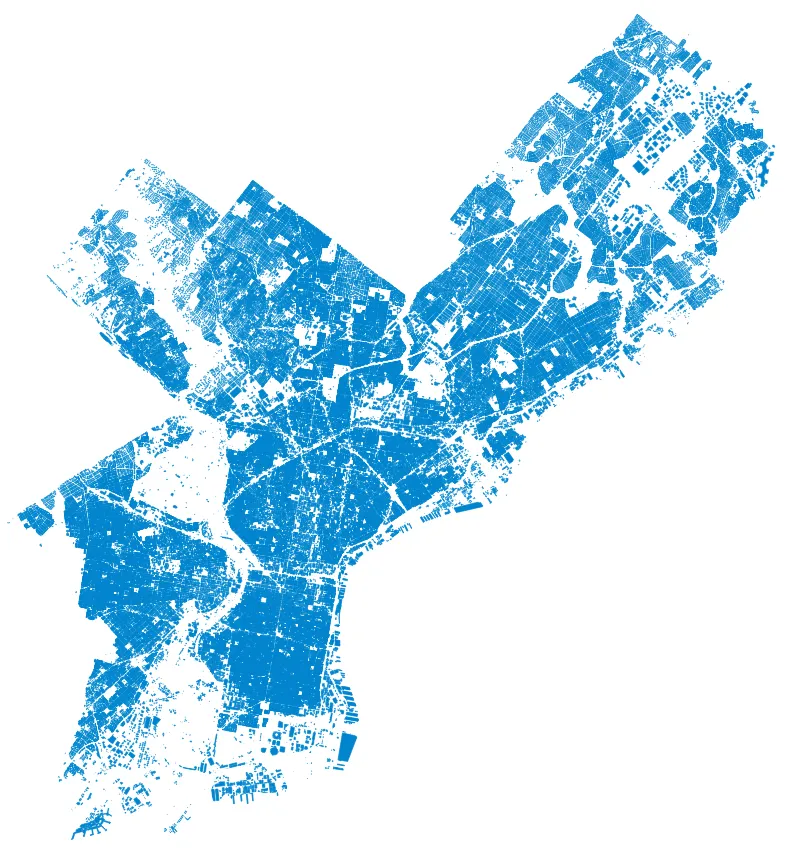
As a result of this collaboration, historical versions of Philadelphia’s urban base layers have been added to the BTAA Geoportal Urban Base Layers Collection, with full documentation of temporal coverage, coordinate reference system, attribute table definitions, and provenance. For example, the 2025 Historical dataset of Philadelphia building footprints is now preserved and accessible through the Geoportal, ensuring continued availability for longitudinal research.
Preserving municipal base layers is not simply about archiving files. It enables:
Longitudinal analysis of neighborhood change
Reproducible research in public health and environmental studies
Accurate historical comparison across jurisdictions
Responsible data citation and documentation
By normalizing metadata, retaining versioned datasets, and maintaining persistent access points, BTAA-GIN provides infrastructure that supports both present research needs and future scholarship.
Philadelphia represents one step in a growing network of municipal partnerships contributing to the Urban Base Layers initiative. As additional cities join the effort, BTAA-GIN continues building a distributed, sustainable framework for preserving the foundational geospatial data that underpins urban research.
This work reflects the broader BTAA vision of a shared, networked “BIG Collection”—one that includes not only books and datasets, but also the infrastructure, expertise, and collaborative relationships necessary to steward knowledge responsibly over time.
Cities change every day. Preserving the data that documents those changes ensures that future researchers can understand how—and why—they happened.