This month, BTAA-GIN is highlighting a new step-by-step tutorial that shows students and faculty how to apply deep learning models to geospatial data. The tutorial uses high-resolution aerial imagery from the BTAA Geoportal to teach machine learning workflows for spatial analysis.
What makes this possible? BTAA-GIN's work curating geospatial data and applying standardized workflows and metadata. This behind-the-scenes effort to ensure authoritative, well-described data means researchers can move directly from discovery to hands-on analysis using familiar GIS and data science tools to explore patterns, detect features, and ask new spatial questions.
As BTAA-GIN continues shaping its FY26-FY28 roadmap, examples like this show how shared collections continue to evolve alongside changing research and teaching practices across Big Ten universities.
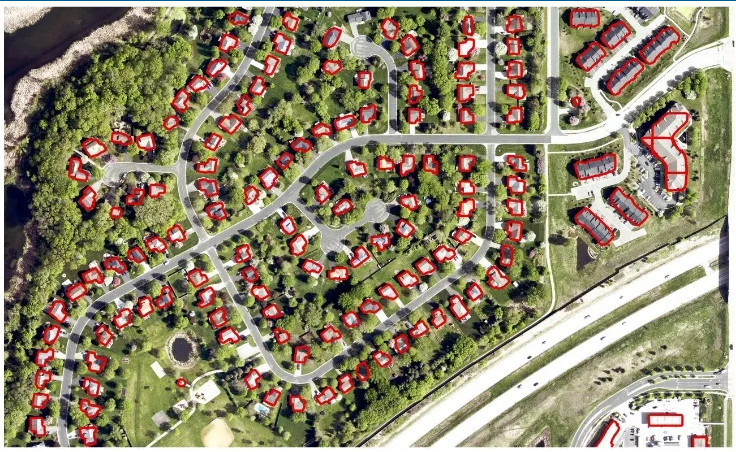
Aerial imagery showing residential units outlined in red as detected by the AI model.