TECHnology
- Held kickoff meeting in September
- Lead developer gave presentation on new technology stack goals and progress
To make the BTAA Geoportal even easier to use, we’ve launched a new series of video tutorials demonstrating common BTAA Geoportal search strategies applied to real datasets. These short walkthroughs show practical techniques for combining keywords, filters, and map-based searches to quickly locate the data you need.
Watch the full series on our YouTube Channel: @GeoBTAA
1. Introduction to the BTAA Geoportal
An overview of the BTAA-GIN, who we serve, and how the Geoportal connects geospatial resources across Big Ten universities.
2. Searching for Vector Datasets
Learn to locate vector datasets showing 1930s-1940s redlining maps for Pennsylvania cities, using keywords, facets, and the map filter.
3. Finding Historic Maps
Find digitized historic campus maps from Big Ten universities using keyword searches, filters, and the map interface.
4. Finding Land Cover Data from LiDAR
Search for Iowa’s 2009 land cover dataset derived from LiDAR returns, using both keyword and facet search methods.
The tutorial series includes:
Designed for researchers, students, and librarians alike, these tutorials help users navigate the Geoportal more effectively and discover datasets with confidence.
TECHnology
Community Engagement
Knowledge
Discussed indexing geospatial data from open-access ETDs in the Geoportal
Coordination
Did not meet
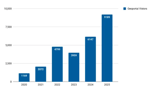
Total records as of October 1, 2025: 116,953
| Title | Records added | Records retired |
|---|---|---|
| 2025-09-02 Scan ArcGIS Hubs | 219 | 31 |
| 2025-09-09 Scan ArcGIS Hubs | 45 | 61 |
| 2025-09-16 Scan ArcGIS Hubs | 49 | 73 |
| Reharvest Mapping Inequality | 314 | 538 |
| Reharvest Newberry Library | 0 | 0 |
| Datasets (USA and international | 8012 | 2 |
| Total | 8639 | 705 |