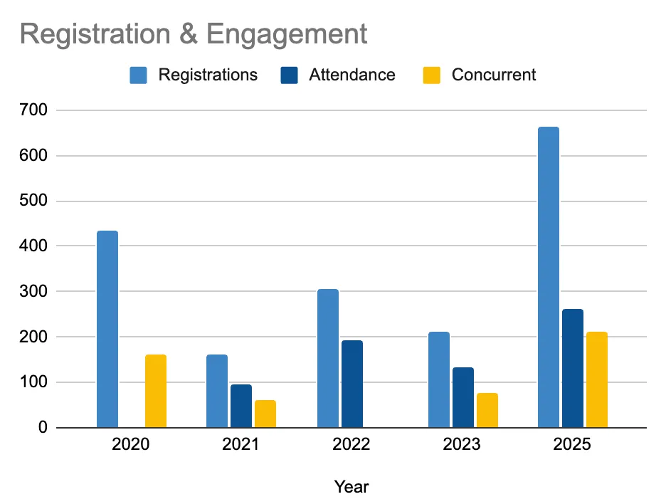
The fifth annual Big Ten GIS Conference, held virtually on April 11, 2025, marked a milestone for BTAA-GIN. With 664 registrants from 230+ institutions, the event tripled registration from the previous year and drew participants from academia, libraries, government, and research communities.
Keynote speaker Dr. Emily Fairfax (UMN) delivered a widely praised talk on beavers and climate resilience. Three themed sessions and a lightning talk block showcased diverse work from students, professionals, and faculty.
A twofold increase in presentation proposals led to a new formal review process, including anonymous evaluation and attention to balance across institutions and topics.
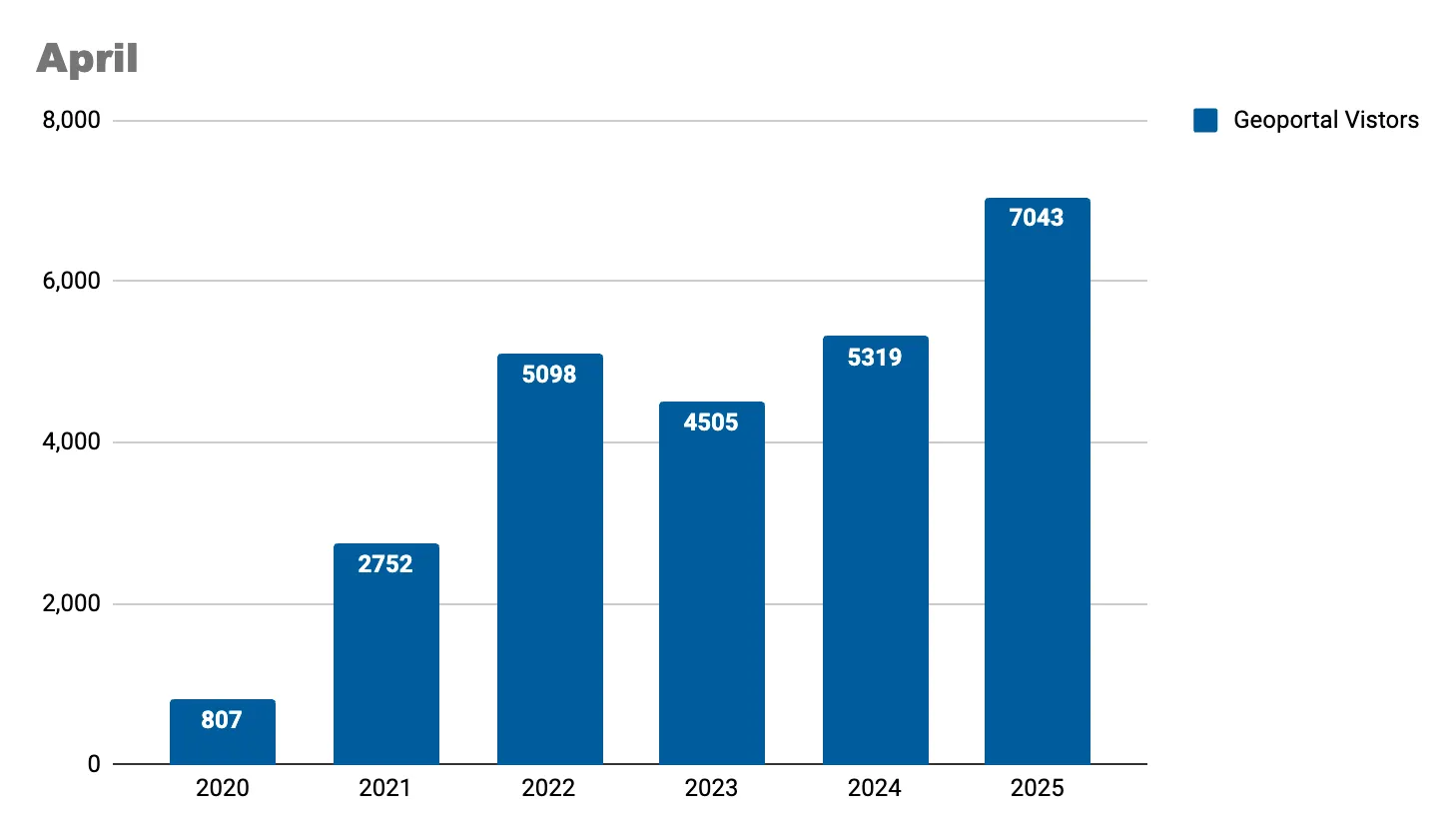
This year, the conference moved from its traditional November date to April to avoid conflicts with GIS Day. The record-breaking turnout suggests April is far more accessible. Save the date—April 2026—and look for faculty outreach to begin in fall 2025.
The success of the 2025 conference reflects BTAA-GIN’s growing visibility and influence in shaping shared geospatial infrastructure and collaboration across the Big Ten and beyond.
BTAA-GIN also launched its new quarterly newsletter, Coordinates, in April. The first issue was sent to 700 recipients, including conference participants, GIN members, and key stakeholders. The newsletter provides regular updates, highlights member contributions, and promotes collaboration across the network. Sign-up here to receive Coordinates.
Discussed outcomes of FAST Subject Headings Workgroup.
Updated documentation and metadata template to reflect the latest metadata profile fields (B1G custom elements).
Community Engagement
Reviewed the first draft of new Geoportal tutorial videos for feedback and held a debrief on the 2025 GIS Conference.
Published Collections Story: Building the Historical Maps of New Jersey with Michael Siegel, Staff Cartographer at Rutgers–New Brunswick.
Knowledge
Continued planning the upcoming geodata rescue sprint, coordinating logistics for dataset review, download, and upload via UMN Box, and developing tools to prioritize at-risk federal and state data for preservation.
Coordination
Did not meet due to the Association of College and Research Libraries (ACRL) Conference.
Drafted and shared with GIN a set of initial guidelines for using FAST subject headings, which offer easier maintenance than traditional Library of Congress terms.
Identified the need for a shared template, consistent cleanup practices, and potential automation strategies.
Finalized and distributed a survey to GIN members to assess how GIS services are structured and delivered across BTAA institutions, with results to inform a forthcoming report on service models, strategic planning, and best practices.
April efforts prioritized documentation and knowledge sharing over new feature development, in preparation for upcoming conferences.
Developed presentation materials on the planned transition of the BTAA Geoportal to a data API service, as well as two upcoming Geo4LibCamp workshops: one on AI-assisted coding tools and another on deploying GeoBlacklight via GitHub Pages.
Released a minor BTAA Geoportal update with improved labeling throughout the GBL Admin interface to enhance usability.