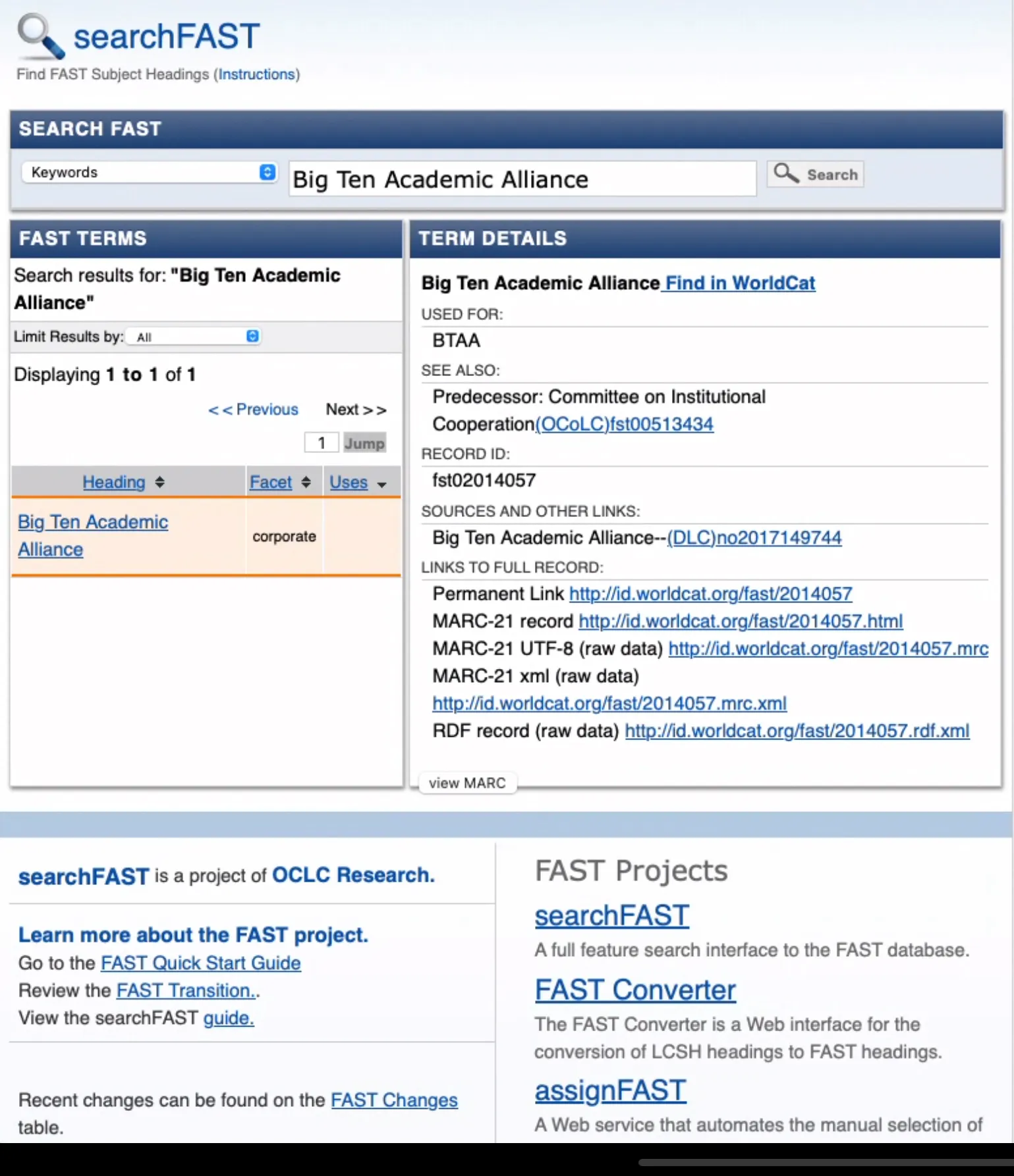
The BTAA-GIN FAST for Subject Terms Workgroup explored using FAST (Faceted Application of Subject Terminology) to improve search and discovery in the BTAA Geoportal. FAST, adapted from Library of Congress Subject Headings (LCSH), offers a more streamlined and accessible way to tag metadata.
The group developed guidance for applying FAST terms across records in the Geoportal, both retrospectively and going forward. This work aims to make geographic data more discoverable and useful for researchers across member institutions.
Big Ten Academic Alliance in the OCLC FAST interfaces
Because place names and inconsistent keyword data complicate the use of FAST, it’s unclear how easily terms can be applied or extracted from existing or incoming records. The group is considering options such as developing broad category headings and metadata guidelines, or requesting MARC records and data from local systems. Metadata from Indiana University and the University of Minnesota will be reviewed to better understand current challenges.
Previewed the draft Strategic Technology Plan 2025-2026.
Reviewed candidates for potential data preservation/rescue and discussed the benefits of establishing a workgroup to update the collection development policy.
Community Engagement
Committee members committed to personally inviting at least three colleagues to the upcoming conference and group brainstormed “Did You Know” factoids to highlight the BTAA Geoportal during event breaks.
Published Collections Story: Discovery of Geological Maps in the BTAA Geoportal by Tara Anthony, Penn State University Libraries.
Knowledge
Provided examples of at-risk data to consider for the geospatial data archiving pilot and facilitated an full GIN discussion on politically at-risk state datasets at the March program team meeting.
Coordinated logistics for an upcoming April sprint on Geodata archiving, including access to storage for external participants, folder structure for tracking activity, and a review workflow using shared Hub spreadsheets. Participants will prioritize and manually download federal datasets, with a focus on shapefiles, hosted feature layers, and Heat Watch data.
Coordination
New members joined to learn more about our committees to assist them as they decide where to get involved. Ryan introduced GIN’s collaborative structure and the Coordinating Committee’s central role. Individual committees — Knowledge, Community Engagement, TECH — shared their focus areas, current and upcoming work, and cross-committee collaborations.
Discussed the 2/28 Executive Committee Meeting and their input on and support of our draft Strategic Technology Plan.