The Urban Base Layers project is a curated collection of foundational geospatial datasets from major cities across the Big Ten region. These datasets support research across many disciplines, including housing studies, land use, urban planning, environmental change, and civic infrastructure. The project’s goal is to make these resources easy to find, well documented, and accessible for both current and future researchers.
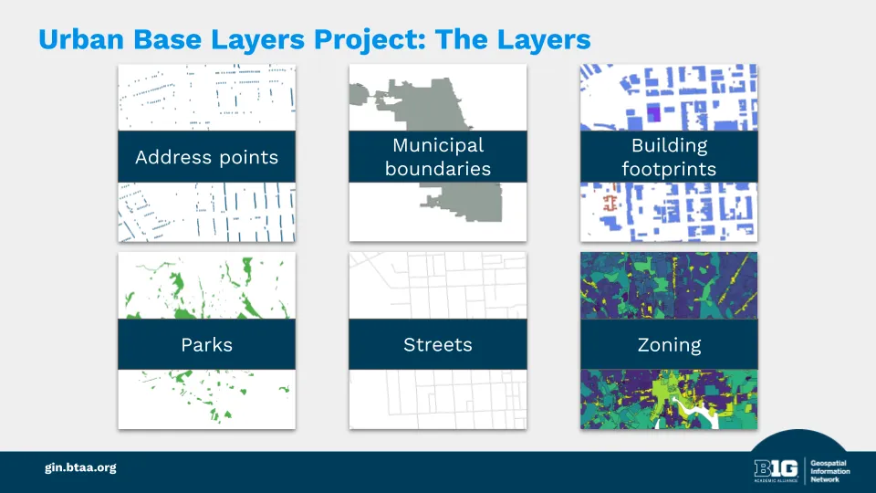
We collect six core datasets from each participating city:
- Address points
- Building footprints
- City boundaries
- Parks
- Streets
- Zoning districts
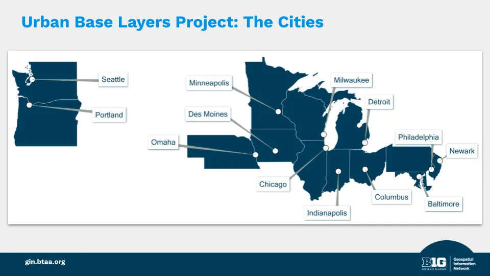
Our initial scope includes the largest cities in each state of the BTAA region:
- Baltimore
- Chicago
- Columbus
- Des Moines
- Detroit
- Indianapolis
- Milwaukee
- Minneapolis
- Newark
- Omaha
- Philadelphia
- Portland
- Seattle
- Years: The project begins with a 2025 snapshot of major metro areas across the Big Ten region. Additional retrospective snapshots may be collected after the 2025 set is complete.
- Data sources: Original files obtained directly from city GIS contacts.
- Metadata: Created by BTAA GIN staff with input from data providers.
- Attribution: Cities retain credit as the creators and publishers of the data.
- Publication: Datasets will be indexed in the BTAA Geoportal with clear source and date labels.
- A collection of foundational layers that support current and future research
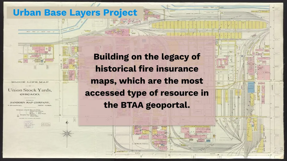
- A complement to the legacy of historical fire insurance maps, which are the most accessed type of resource in our geoportal by a wide margin
- A reusable framework for collecting both retrospective and future snapshots
- A partial remediation of the temporal gaps in available geodata from the early 21st century
- Work with city GIS staff to obtain original-format datasets and metadata
- Document the datasets using the OpenGeoMetadata profile
- Create web derivatives for previews (thumbnails and PM Tiles)
- Upload datasets to storage buckets
- Index in the BTAA Geoportal
The Urban Base Layers project is the first collection in our Geodata Collection initiative.